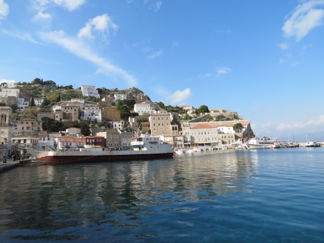
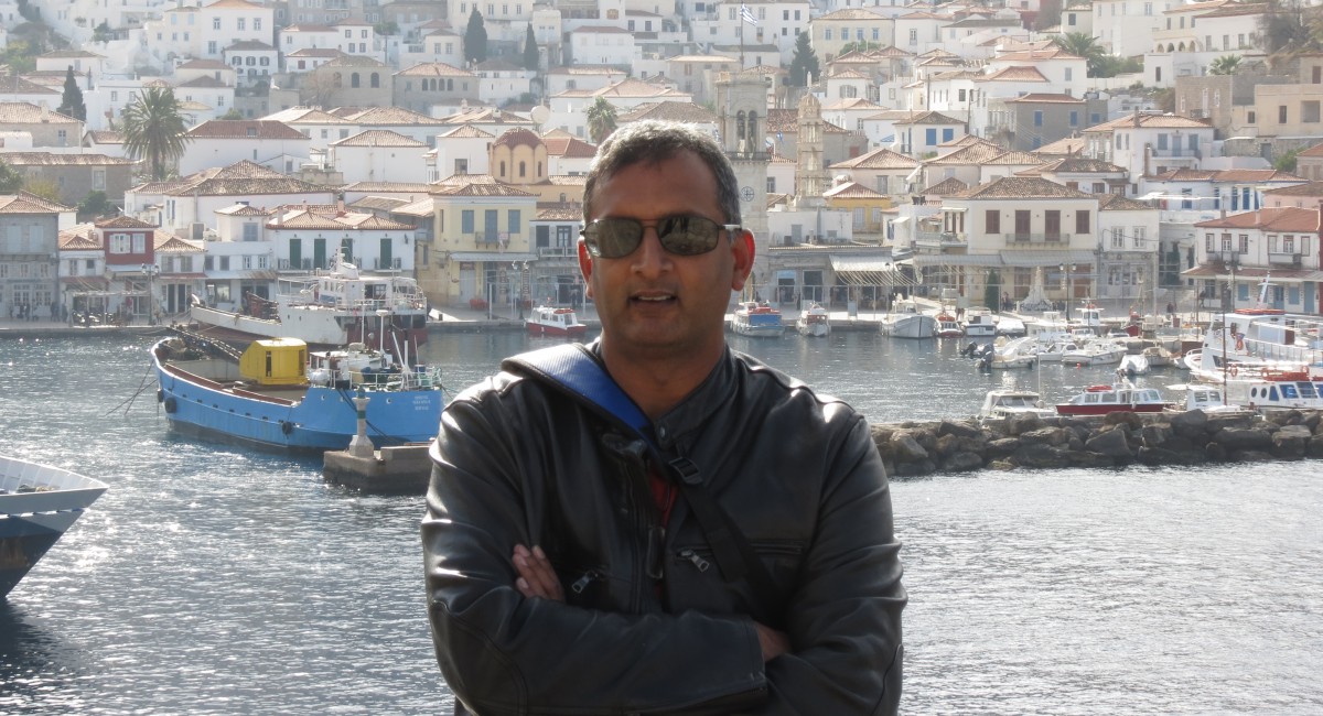

The end of summer was just about the perfect time to get into Iceland. With the pandemic having parked us all within the confines of home and WFH, travel was at first a luxury but for a globe trotter it became a necessity.
Picking Iceland was easy. I had been there before for a brief bit and always dreamt of taking a comprehensive tour so it was what we embarked on. From doing a comprehensive research of things to do before and during the trip to actually embarking on this Arctic adventure it was all quite an adventure. It wasn’t backpacking, it wasn’t taking tours and it wasn’t about going there to click photographs of the magnificent landscape, but it was about driving around the ring road of Iceland anti-clockwise moving always, stopping for hikes while taking in those spectacular images of fire, water and ice. I’d call this a “Carpacking” adventure.
So check out all those travel pre-reqs-
Get your COVID testing done 72 hours before you arrive- PCR or Antigen, either will do. Remember to pre register on the Iceland government website to get a bar code before you get on the plane (travel.covid.is). Also make sure to carry your vaccination certs. And lastly book your COVID test appointment on the same website and schedule it such a way that you can have that done 72 hours prior to your scheduled arrival. Costs 50 Euros for a PCR and 30 euros for the Antogen test. One more thing, carry your own booze and water bottles. Iceland is wonderful but you don’t want to be found short of these commodities while on your trip.
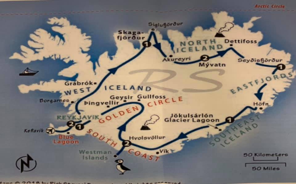
We found the best way to follow our ambitious route was rent a car from the Keflavik airport. The off we go. We had to cover so much ground. And also while the distances are miniscule compared to North American standard, speed limits are low and fines are very punitive. You could be driving at 90 kmph before you suddenly realize the speed limit is down to 70 before getting down to 30.
Day 1– Straight from the airport heading east along the south coast- The Golden circle that had the Thingvellir National park, The Geysir (The Strokkur was especially a miniature version of Old faithful but erupted almost every 4-5 minutes accompanied by the ooohs and aahs). Next was the awesomely spectacular Gullfoss. Then the trip on Route 35 to the Kerid Crater. Spent the night in Selfoss- An uplifting town of 8000 right by the river.

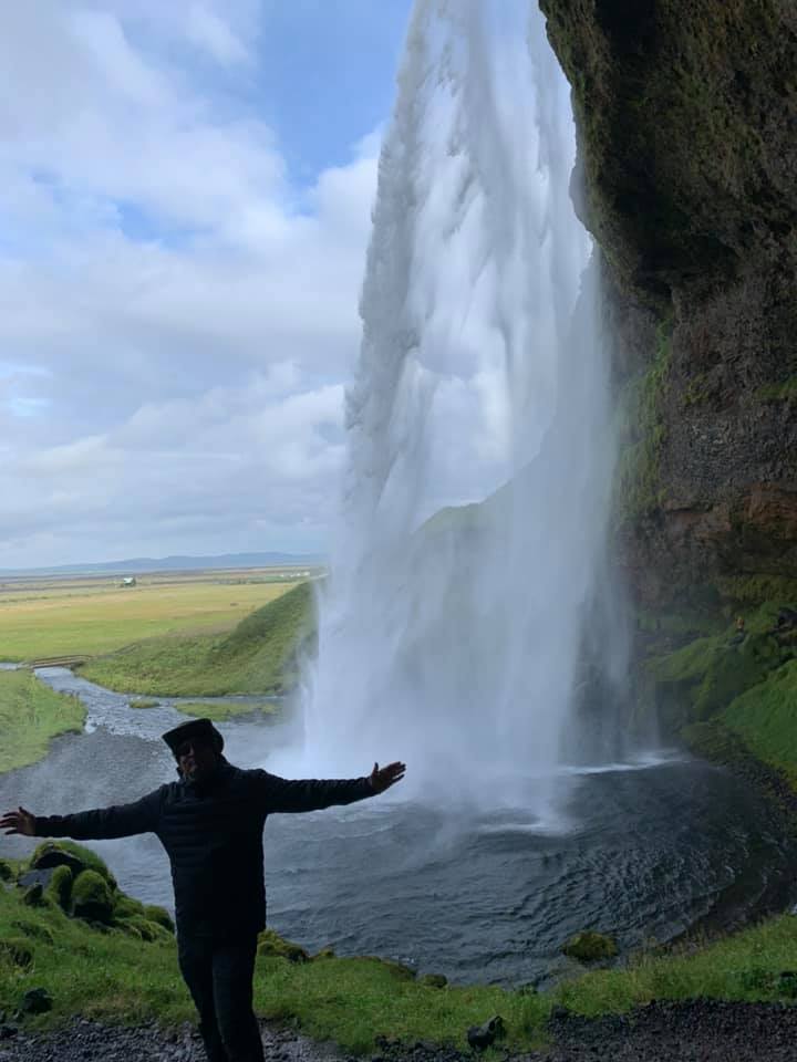
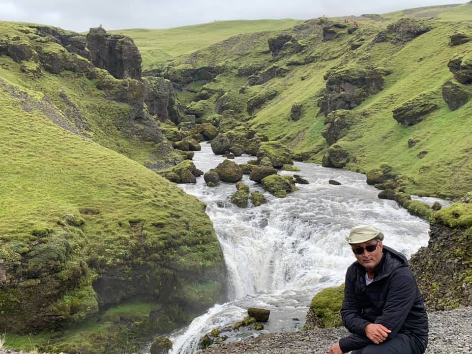
Day 2– Long day. Headed along the south cost on Route 1 making our way south east. So much to do, so much to hike so much to cover. Seljalandsfoss (Where you could actually hike up and behind the falls). There are two other falls in the vicinity and one of the falls is hidden inside a cave. Feels like a dream. Next stop was Skogafoss where the climb upto the top was a great cardio workout followed by another hike two other falls. And just when we thought we had our workout for trhe day, driving along the south coast we took a left to check out the Sólheimajökull glacier . Well the walk turned out be an amazing hike, where the volcanic rocks dust the icebergs giving it an eerie look. A must do. What we did next , well we shouldn’t have. A flat monotonous walk from the car park to see the DC plane wreck (2 miles one way) by the ocean. Avoid this if you have other things to do. But before we went down to Hofn (stop over for trhe night), we had to go see that treacherous sinister looking Reynisfjara. Having been there before and experienced the sneaky waves, do not turn your back to the water for too long. Its enthralling! Wanted to do the glacier lagoon and the Diamond beach but just ran out of time and it was almost 10.00 when we settled in for the night in Hofn. Hofn is a small fishing village facing the Ocean on the south east.

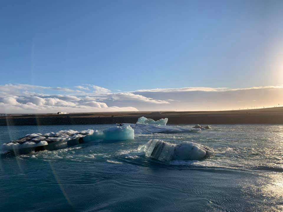
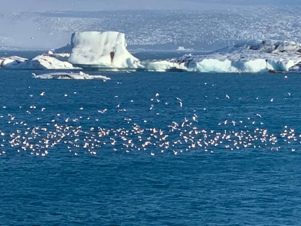
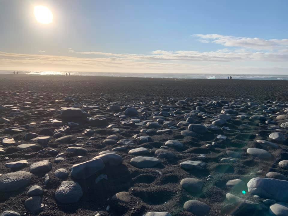
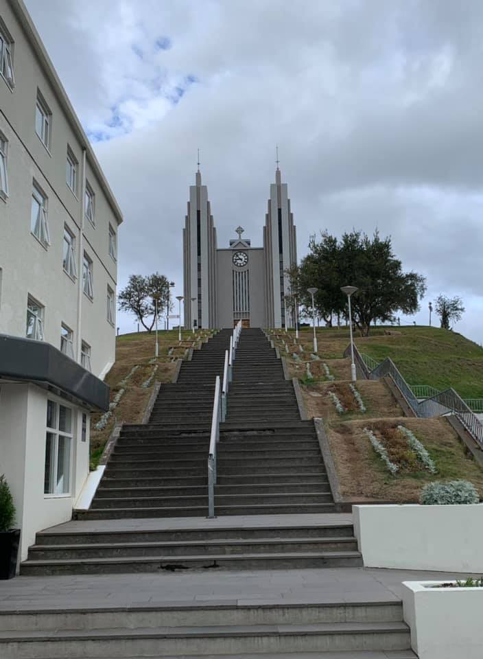
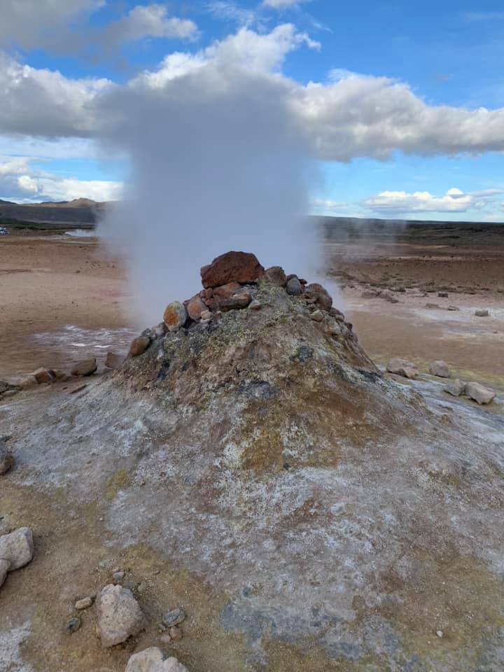
Day 3– Headed back east on Route 1 to get to The Glacier lagoon and Diamond Beach. While it added 100 miles to the trip, it was worth every mile. The Vatnajökull glacier occupies 10% of Iceland and as ice chunks breakaway flowing it to the Ocean. The lagoon had these mini icebergs floating accompanied by some prancing seals. Just across is the Diamond Beach where the ocean carves these icebergs into magnificent ice sculptures and when the sun shines upon these, these truly look like diamonds. Then the journey took us along the eastern fjords, with a small town at the mouth of every fjord. Its all on route 1 and our drive took us to the North. Diamond Circle as its known that has the Dettifoss (very silty, angry waterfall) and the Godofoss (Awe inspiring Waterfall of the Gods where statues of Viking Gods were thrown in when Christianity pervaded the country in the 12th century. Interspersed between these falls was the geothermal fields that has everything you could dream of- Bubbling mud pools, steaming mini volcanoes, mini geysers and the place smells strongly of a high school chemistry lab with all that suphurous gases. The night was spent in the second largest city , Akureyri, a town of 18000, right on the Eyjafjörður fjord. Loved the city and even the clouds cleared enabling us to go on a night adventure to chase the Aurora Borealis. It was perfect timing, away from the city lights and watching the spectacle of the green show in the sky. This was just truly fortuitous.


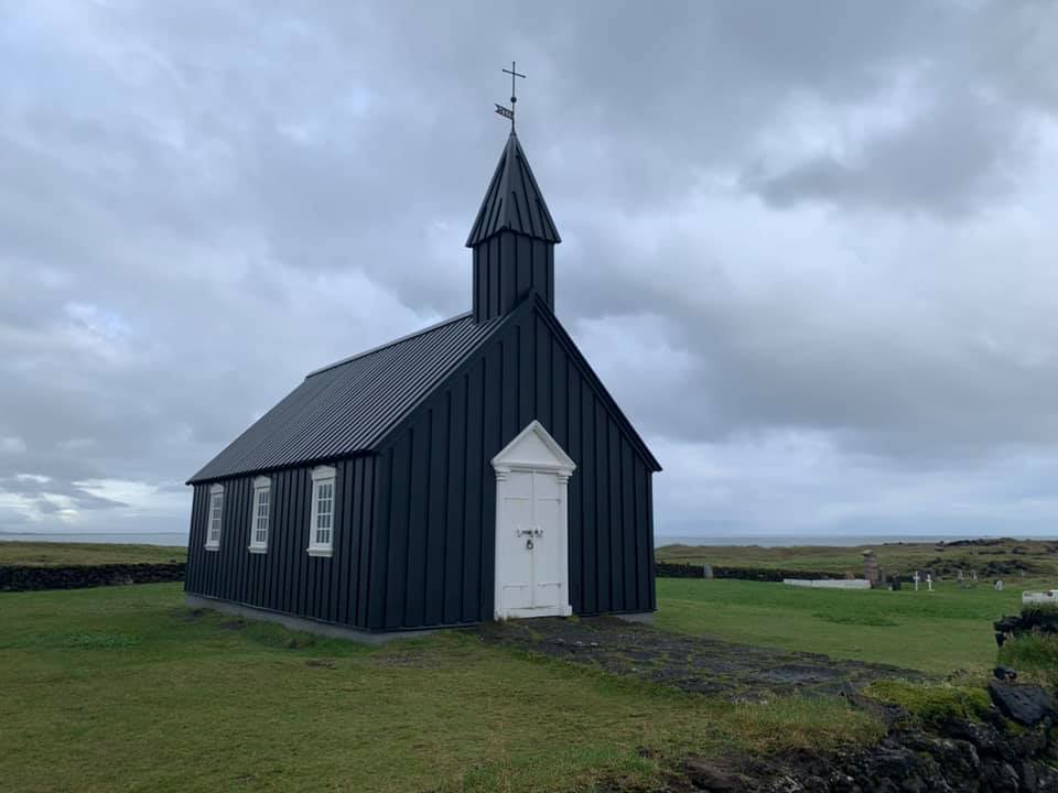
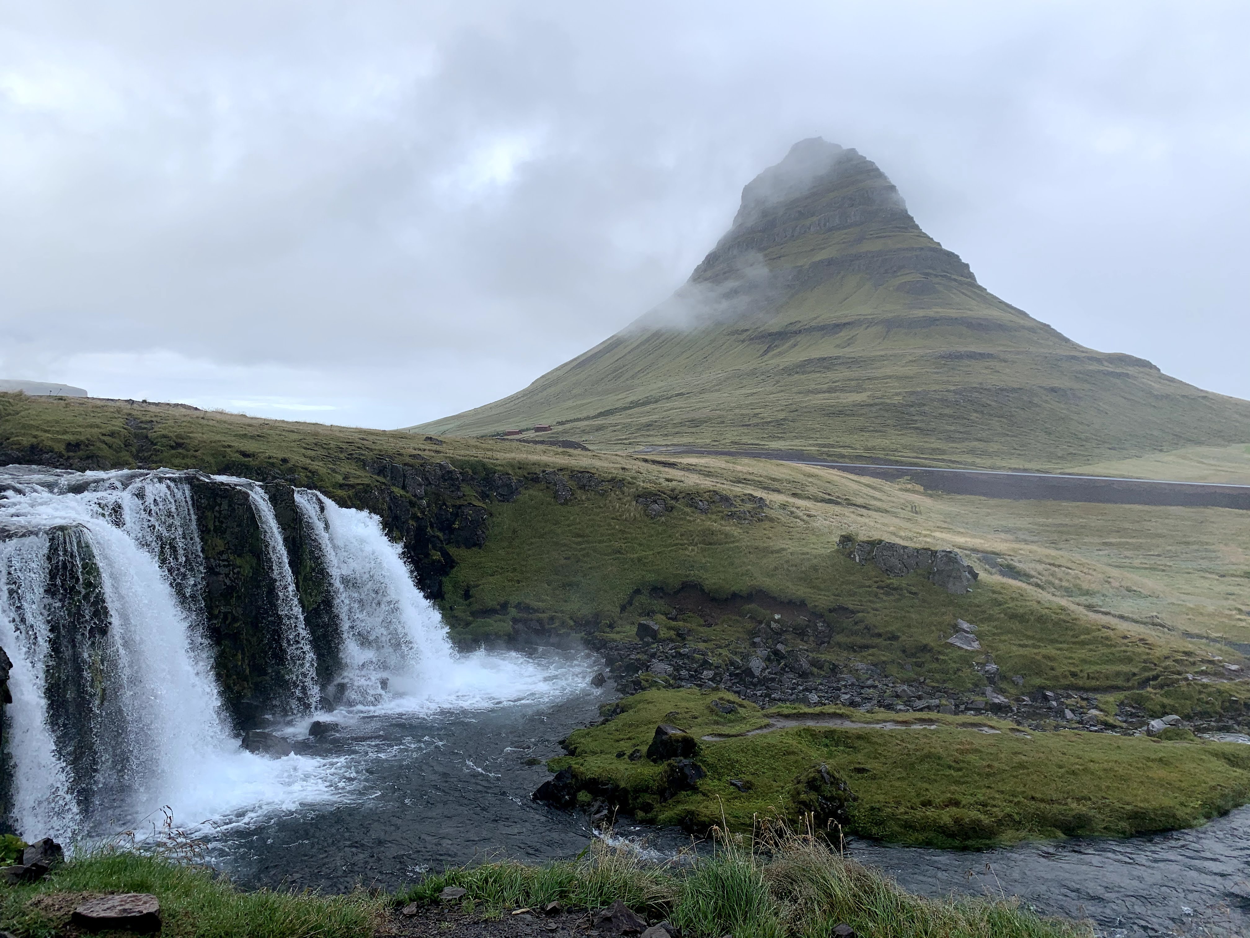
Day 4– In case it wasn’t mentioned before, the gas stations with their kiosks – N1 and Olis are life savers. Great Cappucinos, good eats and well, gas is expensive (almost $7 per gallon). So this day was about driving west from Akureyi to the Snaefelles peninsula. Stop overs at Hvaamstangi to catch the seals but lucked out and saw a whale too in the bay. This country keeps getting better. And entering the peninsula on Route 54, it was just another ooh-aah drive. The town of Grundarfjörður was the gateway to one of the most symmetrical and gorgeous mountain with a waterfall in the forefront- Kirkjufell. A must do. Then driving along the peninsula visiting the old black church in the hamlet of Búðir before taking it “easy” at the Langaholt. So much had been accomplished.


Day 5– This was the day of the west cost along Route 1. From the peninsula to Reyjavik for the COVID test. Good stops on the way with the Goudberg cliffs (free standing basalt rocks), Borganes (picturesque and good place to get gas) then heading down to Arkanes and catch the lighthouses before getting into the capital Reykjavik. Plenty to do, not least the Hallgrímskirkja church situated at the top of the hill overlooking the pretty downtown strewn with cafes, shops and bars. The COVID test was a breeze and I could only marvel at the efficiency of the lab. It was a conveyor belt and got my test results within 6 hours!


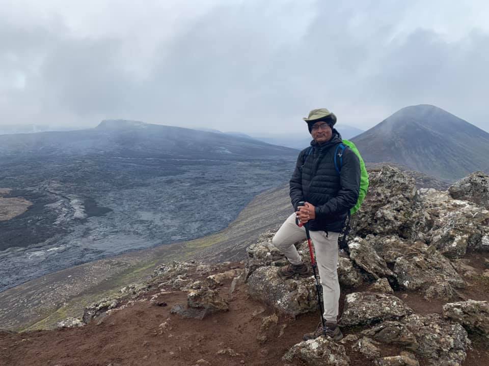
Day 6– This was the day when we got to hike up 1000 feet to be at the site of the active volcano, Fagradalsfjall. This volcano that hadn’t erupted in 800 years started to spew lava and the rivers of fire flowed in 2021. When we went up there , the lava wasn’t flowing but what we saw was awe inspiring. The blackened frozen lava from 6 days ago and the view of the crater from across the valley stood up on the peak. Dreams can become real. After this hike, the blue lagoon reckoned that was quite touristy and then the anti-climactic lunch at the Fridheimar greenhouse tomato farm. I’d say just okay but good for the novelty.


Day 7– Departure day. Good duty free at Keflavik . Iceland- I may be back- yet again!
