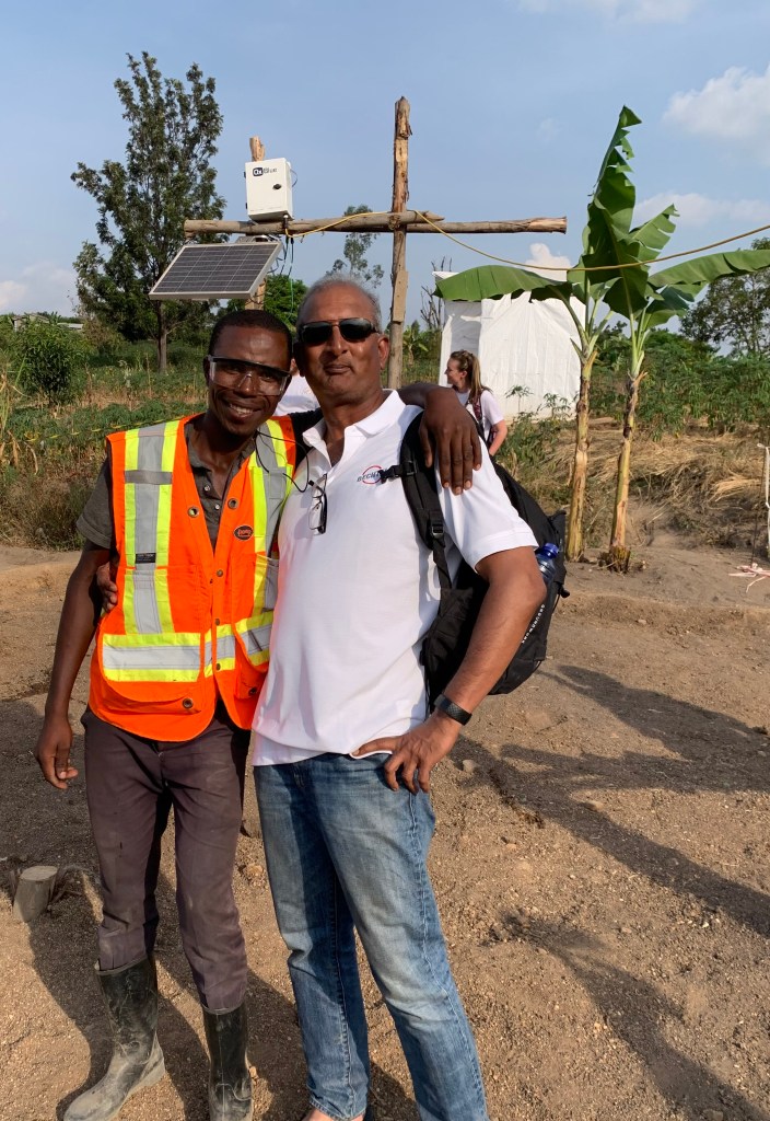
My own piece on my mission to Africa- Opinions are my own, mostly facts and any resemblances to goats, people are purely intentional.
The Bridge that launched a million smiles!
The bridge the mission and instances of my own ineptitude!
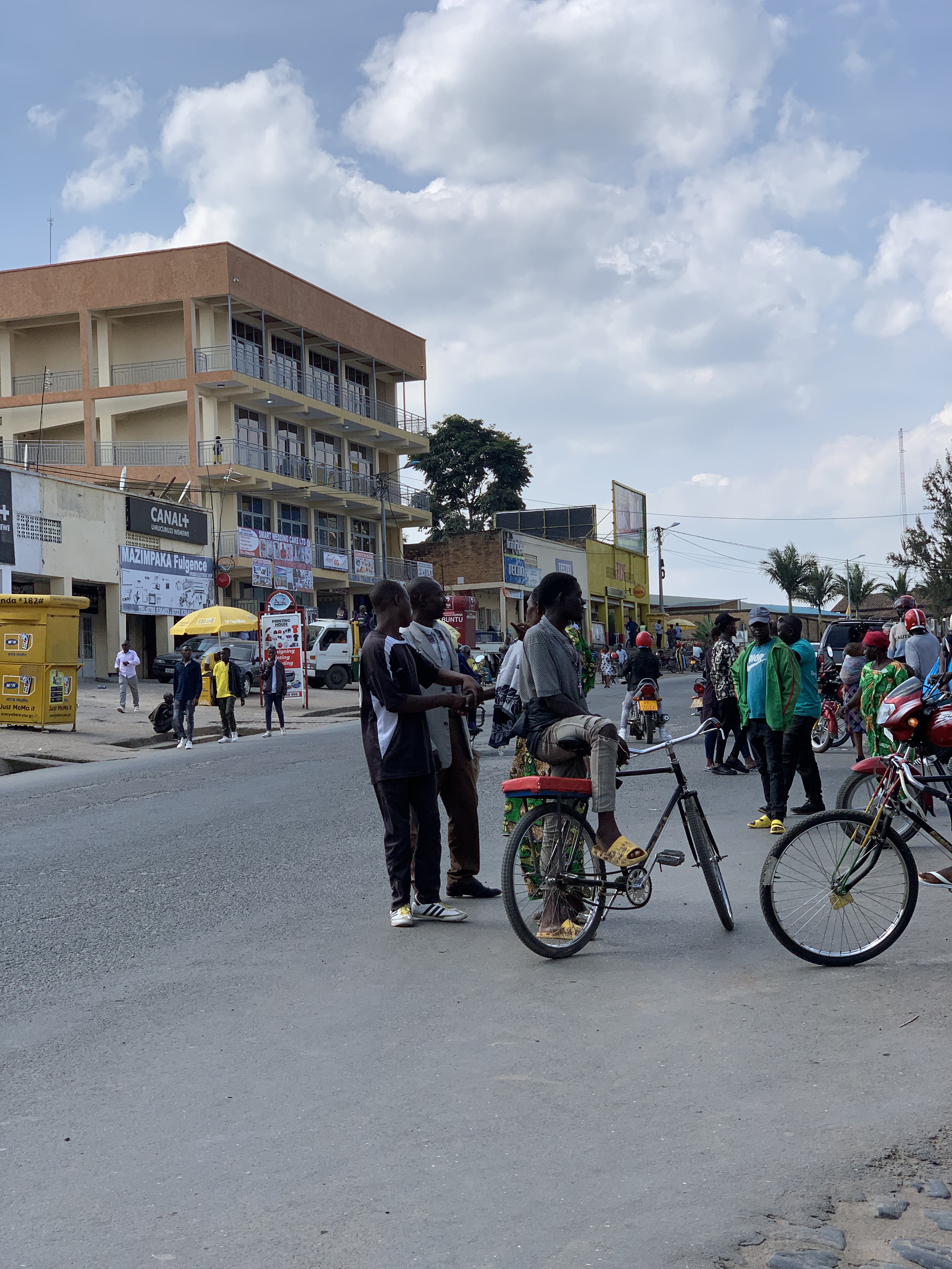
Embarking upon the mission was a mix of nervousness and excitement and in spite of several discussions with my predecessors I had that lurking fear of heading into the unknown. Wikipedia, You Tube, first hand accounts do not prepare you well enough, you can watch, you can read, you can talk but unless you get your own boots on the ground its hard to experience the feeling of being in Central Africa.
And being a bit wary, the first flag was when the visa I had applied for came back within 48 hours and with an error wherein they had listed my birthplace as Turkey. Little did I know I looked like a Turk (which to me was a compliment!) ; however a simple one line email fixed that. The Rwandan embassy came back to me less than 24 hours later and corrected it and issued me a visa that was accurate. What made it even better was their use of the valediction– “Welcome to the land of a thousand Hills and a million Smiles”. That was that one boost I needed to look forward to my adventure.
The desire to do something different, be part of something that enables a few smiles is what most of us aspire for. And you don’t need to jump on a plane and travel halfway around the world to do that; you could do it in your neighborhood. But what prompted the Rwandan mission was to make a difference to people that are starved of the basics in life, people with real problems, people with real challenges. Not people who complain about the heat and humidity or the fact that their network speed sucks.
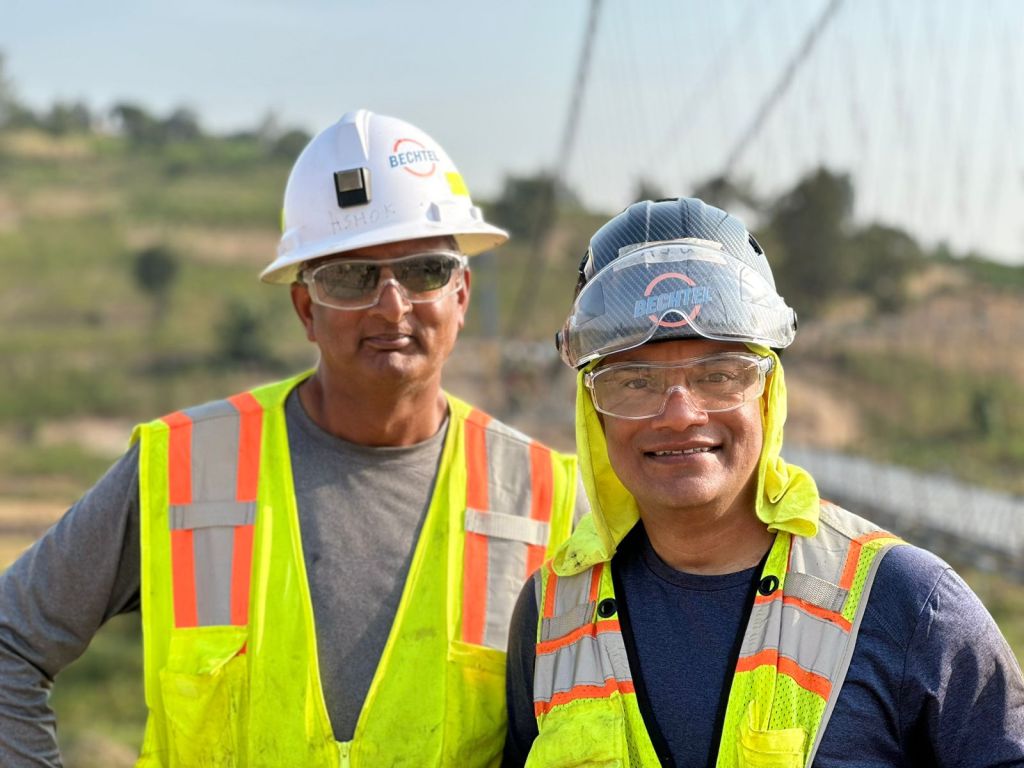
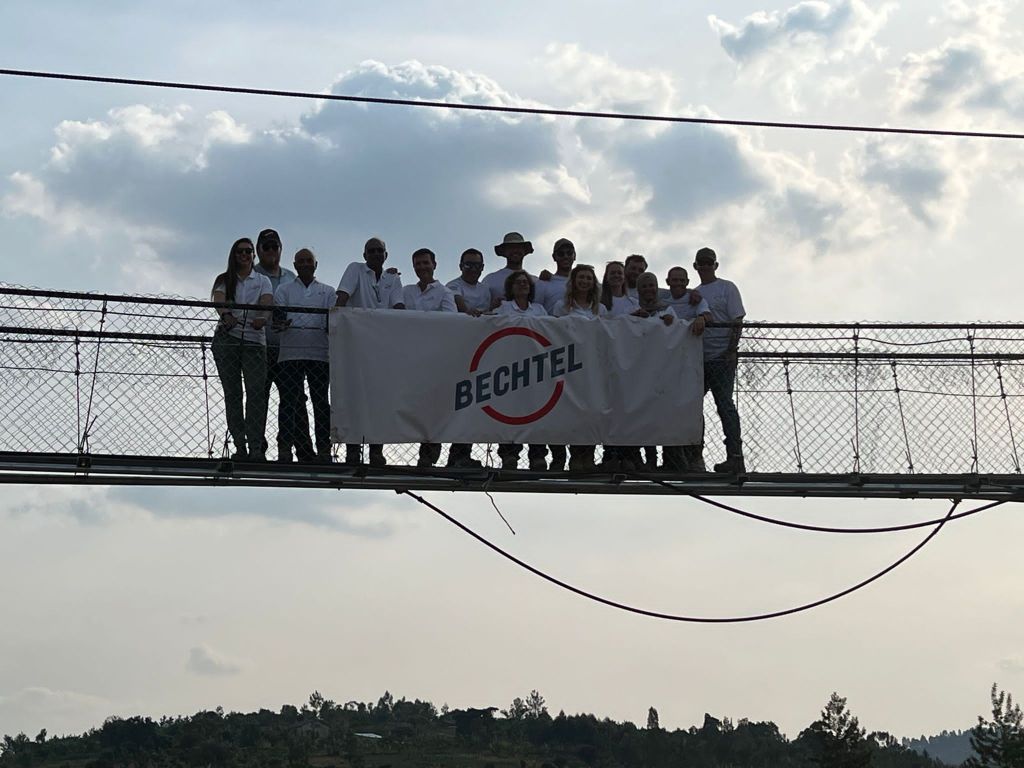
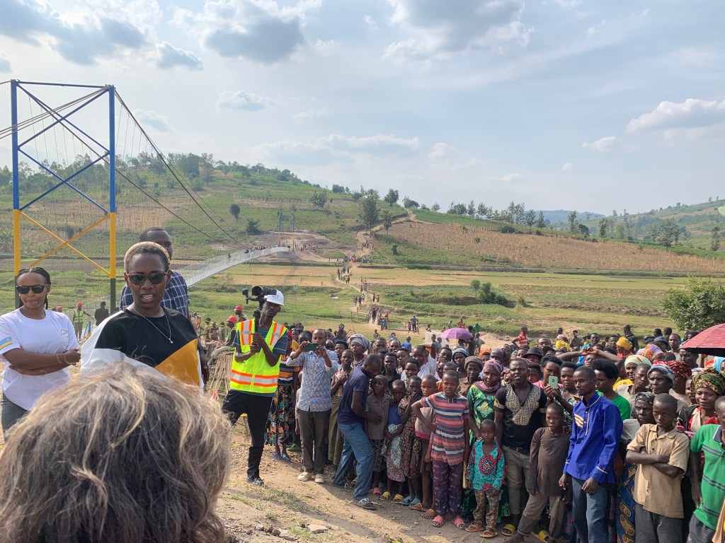
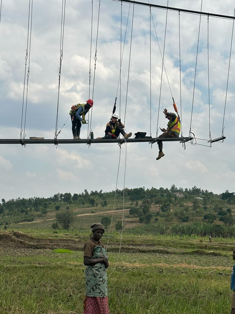
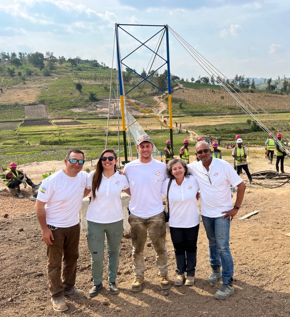
There we are- A team of 15 from different locations around the globe working with Bridges to Prosperity (B2P) to help build a 140M Cable suspension bridge in the Nyanza Province of Rwanda. A place south east of the capital city, Kigali and million miles away from the comforts of home. B2P is essentially a Denver based NGO that work with developing nations and corporate partners all over the world to make the world a better place by building bridges in rural areas. Here’s the link to their website
The funding was almost in place and the thanks to several colleagues and friends, we were able to raise up $60K in just about 3 weeks. Kindness and generosity ain’t dead. The prep work consisted of grabbing everything that may have some use – Getting vaccinated for almost everything but Rabies and yellow fever. After copious reading and research, I found yellow fever shots are not needed for Rwanda and rabies- well that was just way too expensive and I made a mental note not to pet the gorillas or for that matter any mammals when I got there. If I had a compulsive desire to pet a goat in the village I would gladly ask one of my vaccinated co-workers to do it on my behalf!
Visa check, cell phone check, vaccination check, camp mattress check, pillows check, personal safety gear check and of course sun cream. It had only taken me 27 years to realize all skins burn, yellow, white, black and brown- and its not just a White privilege!
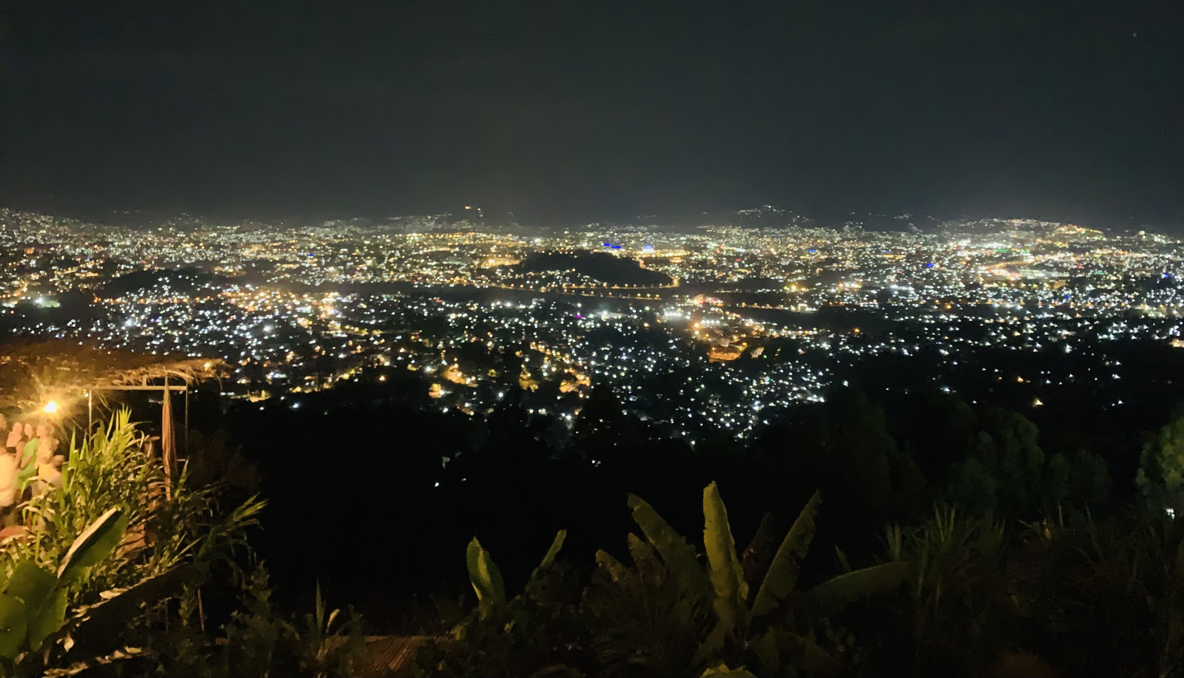
After a long haul flight from Houston to Istanbul and then on to Kigali- That was a journey and a half. What I noticed is the detour flights takes heading into Africa since Sudan was a no-fly zone and I couldn’t wait to get my feet on terra firma. Fortunately better sense prevailed and I had decided on getting there a day early- Acclimatize and getting to spend a day in Kigali. What did strike me on my way in to the hotel was the unlittered clean streets . Just a surprise considering every third world country I have been to , garbage is sort like a trademark. I later found out two very interesting facts. One Rwanda banned use of plastic bags in 2009 and every fourth Saturday at the end of each month, they ban all vehicular traffic for 3 hours and every citizen gets going and helps keep the streets clean. Umuganda is a national holiday in Rwanda taking place on the last Saturday of every month for mandatory nationwide community work from 08:00 to 11:00. Participation in umuganda is required by law, and failure to participate can result in a fine. The program was most recently re-established in 2009, and has resulted in a notable improvement in the cleanliness of Rwanda. That is just awe inspiring and so unexpected but explains a lot.
Rwanda has quite a troubled past and those of us that were old enough to follow world events in the early 90s, the genocide was a highly dark chapter in their history. While it all culminated in three months in 1994, where over a million Tutsis were systematically killed by the Hutus in an incredible spate of violence. Practically families, neighbors and friends turned against each other in an orgy of murder that has thoroughly traumatized society. This chapter of Rwandan history is still green and quite an emotional one and one of the drivers I spoke to in detail opened up to me on the horrors and the aftermath of it all. You are best advised not to broach this rather sensitive saga with the locals. I did get an opportunity to visit the Genocide museum in Kigali, which in itself was a gut wrenching, emotionally draining experience. A must visit if you happen to be there.
Heading to the town of Ruhango and settling in to our accommodations- A shock a surprise but took me about 2 hours to get accustomed to the basics of nature. It was like being in a dorm- Three to five people to a room and a small matter of sharing a communal bathroom; one between the 22 of us including the Bechtel team, the B2P staff and the like. Using the term “shower” is an exaggeration, I’d better use ablution facilities to represent the water filled bucket and the squatter’s toilet. Basic but gives you a perspective of what the local community accepts it as a norm. The sleeping quarters where you start to get used to all the moans, groans and snores which I would christen as the “morbid symphony of Ruhango”
Use of common greetings in Kinyarwanda struck quite a note with the locals and helped “bridge” any apprehensions felt initially. The terms “Mwaramutse” (good morning), “Mwiriwe” (good afternoon”), “Murakoze” (Thank you) were the most popular ones. At work it was a slightly different tone with cries of “Hagarara” (Stop), “Yego” (Ok) and “Tugende” (Lets go) and that reverberated all day long.
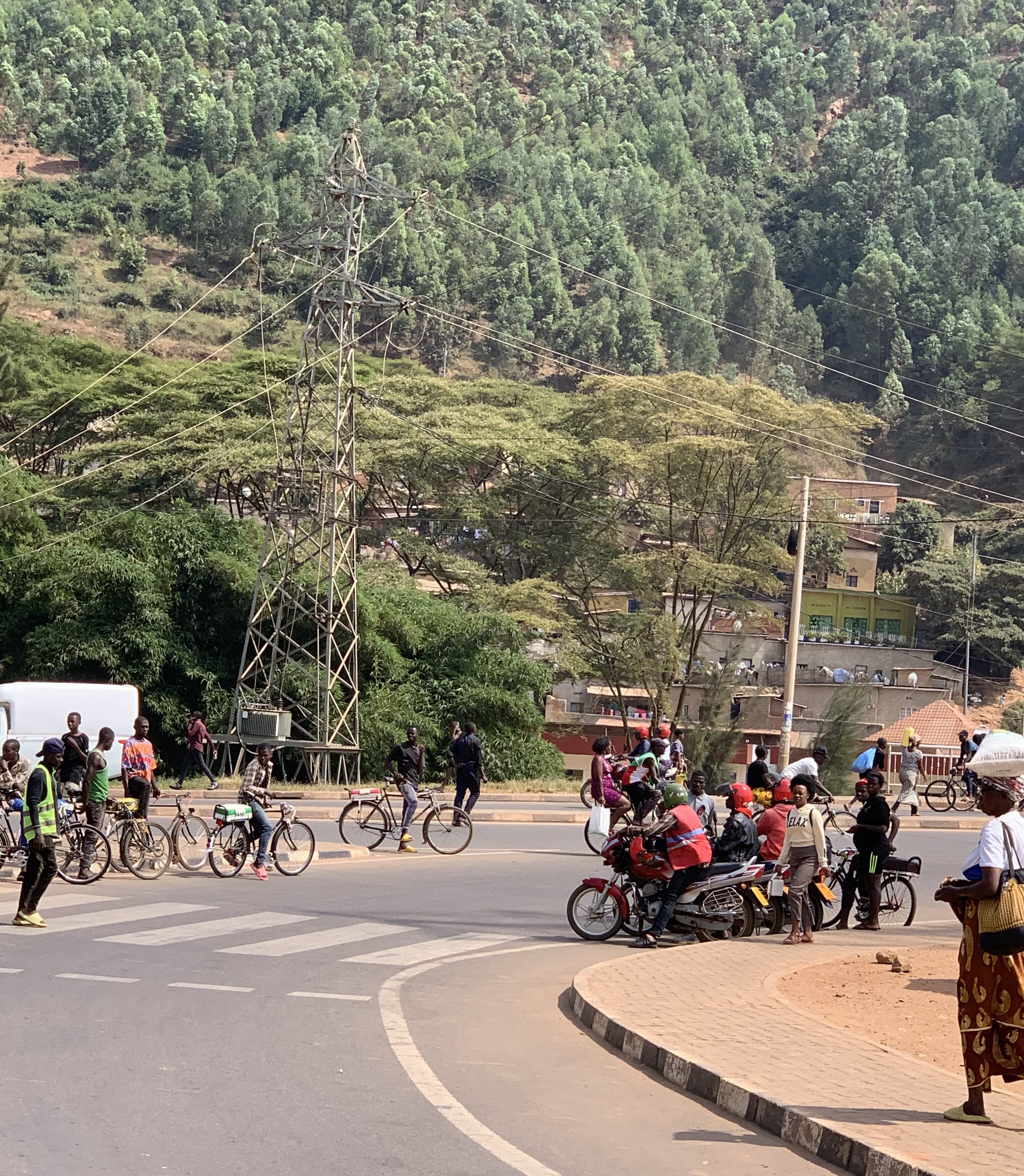
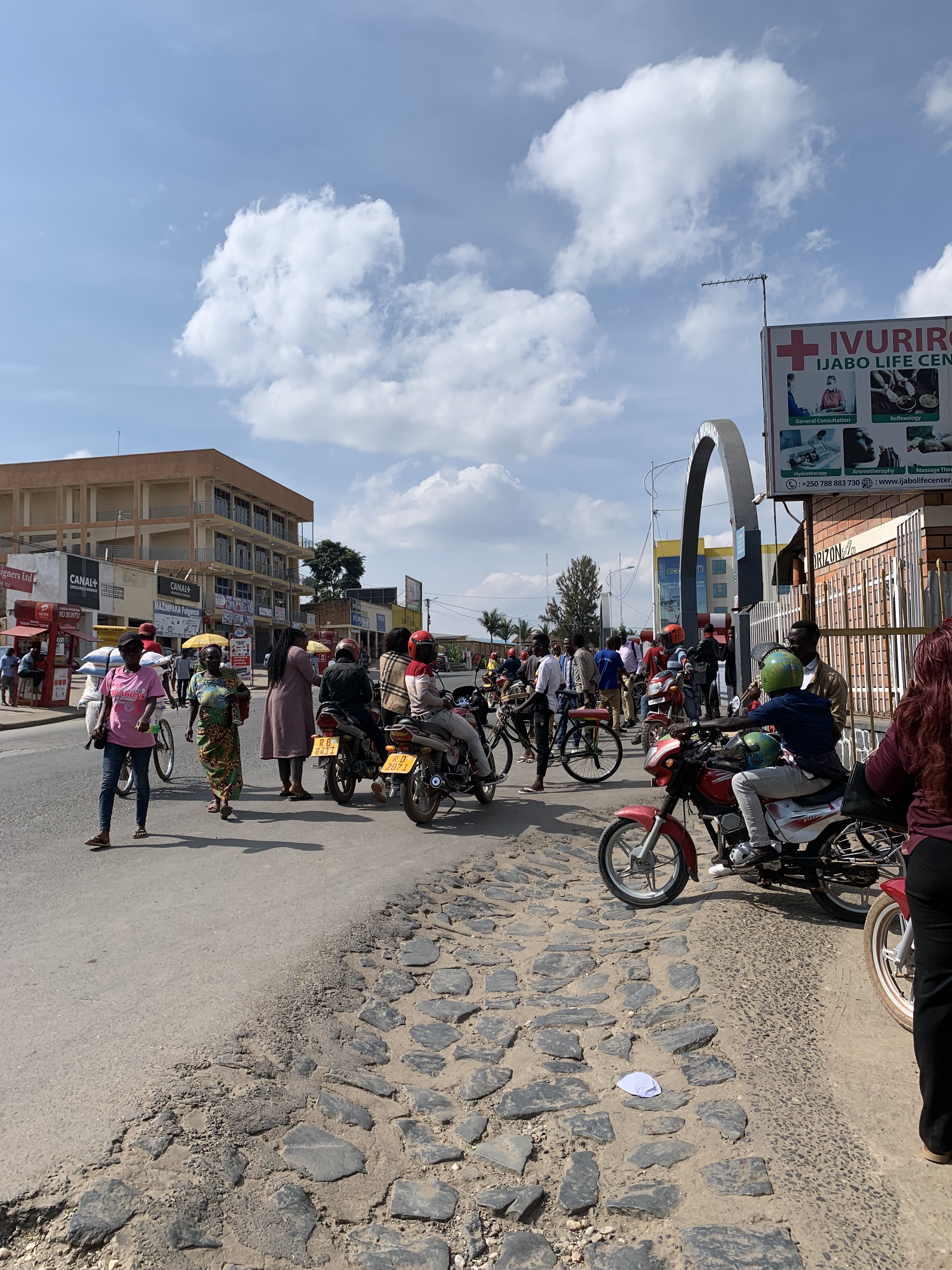
An endearing experience will always be the screams and cries of children that would chase our vehicle through the small hamlets as we commuted to the bridge site. Cries of “umunyamahango” (Foreigner) and “Goo-doo morning” would echo is my head for years to come. And when the kids came over watching the build and some of them venturing out to make friends with us with was just the elixir we needed to keep going. For some of the team, this was highly entertaining and novel but from those that have been to or grew up in impoverished regions, this is just how life is.
The bridge itself- All I can say is the teaming with the local community was a refreshingly amazing experience. The level of collaboration, being in the ditches with them working under the searingly hot equatorial sun was something I had not experienced before. It was hard manual toil and you had to hydrate yourself constantly and not to forget to apply copious amounts of sun lotion and definitely not a walk in the park. That’s something I have to emphasize – Its pure hard work and while it would all seem glamorous on the surface and “cool”, it’s a testimony to the efforts of the crew on the ground and the backroom staff that made this endeavor possible.
And a note on my own skills (or lack of it!)- For a person that had glued his own knees to the floor while installing floor tiles, I am rather proud to come off unscathed. My ineptitude with handling small tools is legendary and I only wish the poor villagers and my co-workers in the Nyanza province did not have to see me monkeying around with impact wrenches, grinders and even a pair of pliers! If Neil Armstrong said that small step was a giant leap for mankind, using an impact wrench to tighten a small bolt was nothing short of spectacular! An Indian in Africa may not be big news, but an Indian trying to wrestle with a grinder on his own without any adult supervision is folklore! And hey who better to make fun of me than me, right! As they say, it all worked out in the end and I am back with all my fingers and toes intact.
At the end of the two week period, we could look back with a sense of accomplishment and be proud of what we had done. Built a bridge that would link the communities together. Built some friendships, built a legacy and in my best German accent I could say “I’ll be baack”
The larger team had a mixbag of characters – From the sublime to the ridiculous, from the protected to weathered professionals, from strategists to wannabees. It takes all kinds to make this work. And one thing of note- People took to drinking warm Primus beer at the accommodations like a duck to water not because they loved it but because it was better than the other option.
And how could I ever miss our partners in crime- The goats. Of course the goats that seem to rule the roost in the valleys of Ruhango. With deep regret and sympathy I must mention we had to procure four of these hoofers to provide a feast to the local craft in form of a barbeque lunch. They were carefully procured, tested , butchered and grilled and apparently they were a hit with everyone, well not everyone so its with mixed feelings I say this with no bias- One person’s sorrow may be another one’s feast.
Cannot say I have regrets- It would have been nice to get a day off and go off see the big 5 at the Akeygera National reserve but they will always be around and we will always be back. Small price to pay for the rewards. Well, the gorillas would just have to wait to get their sighting of Ashok!
Murakoze Rwanda – You are definitely a cherished memory and you did walk the talk- The land of a thousand hills and a million smiles!
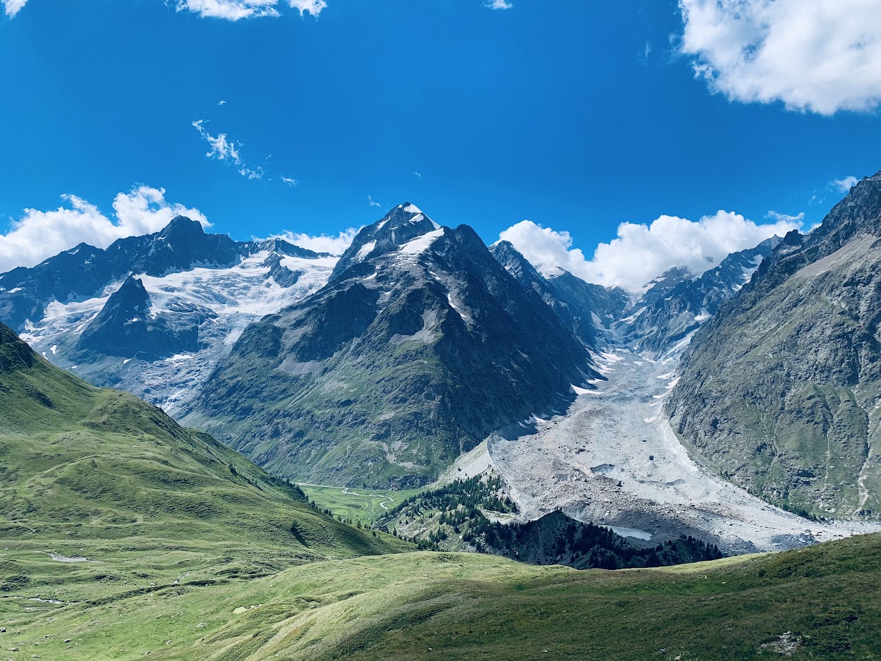
The vision of mountains, glaciers, din of the cow bells and the lush green meadows with rather posh sounding names conjure images of a commercial for Swiss chocolates , fancy watches and appears to be pure bliss. These are the attributes that spells “Alps” and while watching it firmly ensconced on your couches its only adds to the allure, hiking the terrain around the Mont Blanc, the peak of the Alps is a step that takes you even closer to realizing and feeling that dream- Up, close and personal.
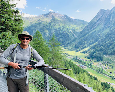
We had been planning to undertake this 7 day hike around Mont Blanc- popularly known as Tour de Mont Blanc (TMB); it’s a hike in the Alps doing either a clockwise or a counter clockwise circuit that takes you across a challenging terrain traversing numerous mountain passes, peaks, valleys, meadows and glaciers. This takes you through the French, Swiss and Italian Alps and for a semi-skilled hiker like me, completing the circuit may be as close as I can get to landing on the moon. The sheer magnificence of the Alps can leave you feeling over whelmed but what comes with it is a massive sense of accomplishment.
Embarking on this journey, I was not that prepared having been living in flat Ontario past few years. My only training consisted of the F45 HIIT (High intensity Interval training) that I have been doing past few months and surely that helped. With that as my prep, I landed in the picturesque town of Chamonix (which hosted the first winter Olympics back in 1924), via Lisbon and Geneva. The journey now begins as we make our way to the hamlet of Le Tour, France.
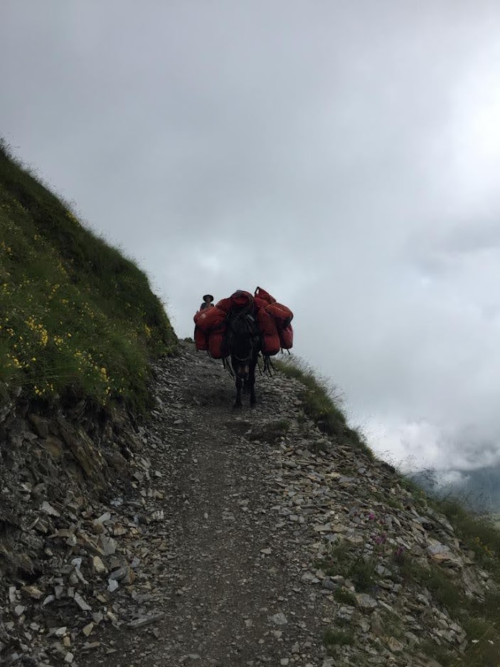
The group had a total of 14 people plus the guide and our favorite companion for the next 7 days, Picasso, the mule. Each of us would carry our day packs – With water, rain jackets, small nibbles, plastic utensils while Picasso would carry 7 kilos (15 lbs) per person and some lunch. The rest of the group were clearly far more skillful than I- having done other strenuous hikes so it was going to be either attempting to match their pace or carry on at a more pedestrian pace. By Day 3 I realized, this was not a race and the winner was not going to be getting any sort of discount. That strategy also afforded me to pace myself nicely while taking breaks and take pictures that would create memories of a life time. I am no snail but I am not one to run circles around others either.
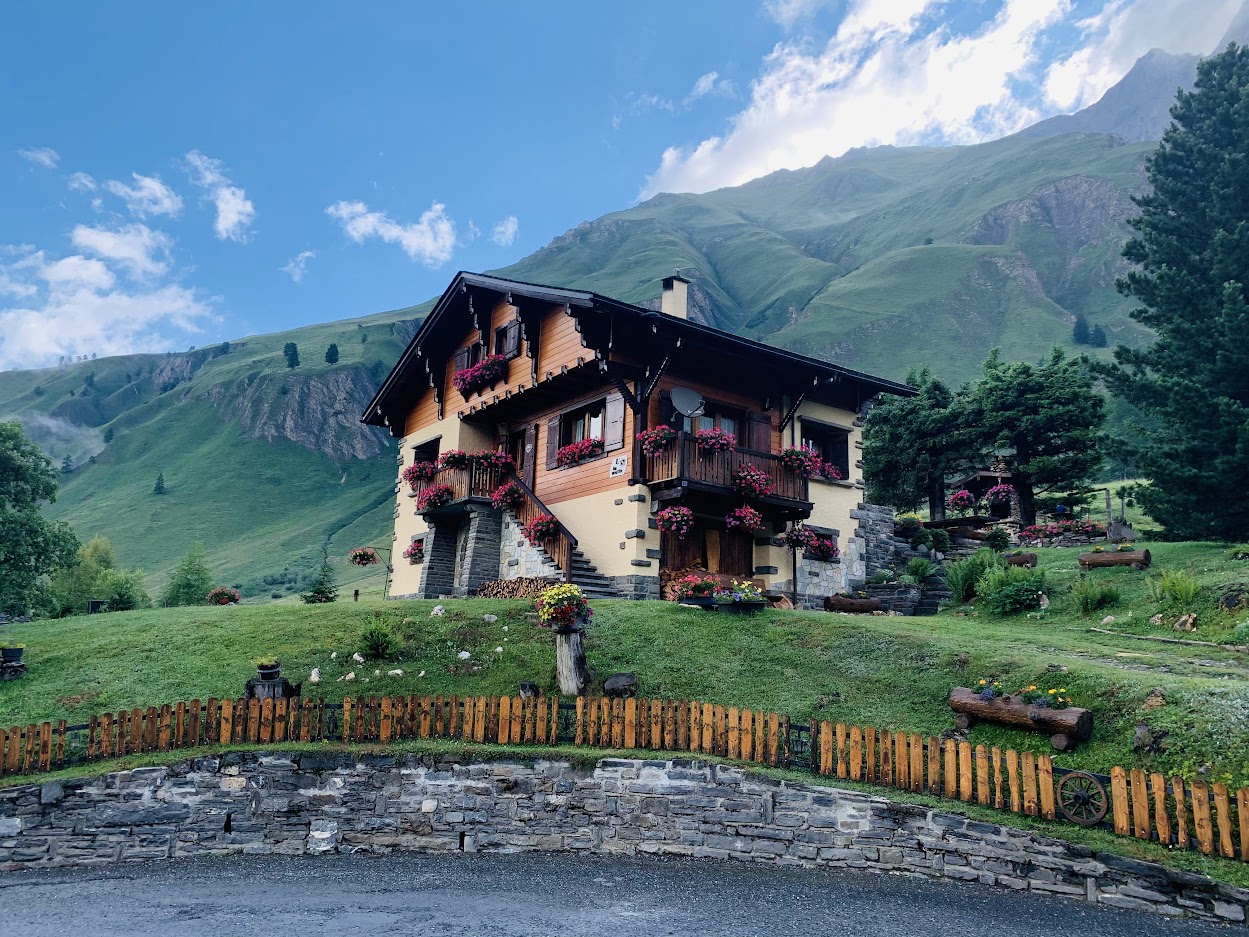
Day 1- With all the enthusiasm I could muster, the trek from Le Tour to Col de Balme started out in open sunny climes and while we ascended upto 1000 m (3000+ ft), the second half of the climb took the wind out of my sails. This was where we made our first border crossing into Switzerland and had the first sighting of Mont Blanc. So lunch at 7,200 ft before descending in the second half the day. Not too bad and just when I thought the day was over when arriving at the Village of Trient, we were told we had another 200m (600 ft) of climb to do before we got to our first refuge. The refuge- Well, it was a smallish room that slept 4 and we always knew we had do a quad on one of the 6 nights, so got that of the way . Common showers and again not too bad. The food consisted of a decent 3 course meal with cold beer. The meals and accommodations were part of the tour fees but you’re on your own for beers.
Day 2- It had rained quite hard overnight so the trek today was upto the area of Le Bovine through steep switchbacks. The second half of the trek led us through open Alpine meadows where the cow bells only became louder. The descent was steep and over rough rocky terrain and never seemed to end. Arrived at the pretty town of Campex du lac before getting on a bus to get to La Fouly. The refuge was slightly better today with a fondue dinner awaiting us
This is when the realization stuck that I have to do this for 5 more days so the mental aspect had to be re-adjusted and had to hit that reset button. This meant I would walk more leisurely, not try to compete with the experts and go at a pace that made the hike fun, as opposed to a chore. This worked wonders and I started to see the landscapes and savor the ambiance more clearly. The bonus of this strategy was those several interesting conversations with other hikers who were either doing solo back packing or self guided tours.
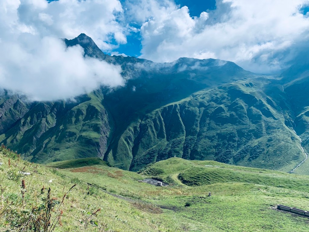
Day 3- My favorite day- Through pretty Swiss hamlets, views of the glaciers before getting to an elevation of 8,300 ft which was the crossing over to Italy. This is when the greeting to other hikers start to change from Bonjour to Buon Giorno! Made our way to the Elena refuge, which was one of the better accommodations. Again the 3 course meal did not disappoint. The beer especially felt special.
Day 4- Had to hike on flat streets before picking up the trail and that was not fun. Its almost like you are itching to get to a climb and lugging a backpack on winding streets can play trick with the head. The second half of the hike was so rewarding that I walked slower than usual to take in the panoramic views of Mont Blanc which seemed to get closer and closer as I hiked. Ended the day at the Bartone Refuge where you had to slip in coins to get hot water flowing to get your shower. Not bad considering the options. The toughness of Day 5 was all I had in mind and had to try to compartmentalize different phases to help get to sleep
Day 5- A two hour downhill hike to a jewel in the Alps, the town of Courmayeur was not bad at all, but going around town during the brief stop over, figured some of us could take the cable car and knock off 500m especially the climb did not look too attractive and monotony screamed. After spending an hour in town, joined the rest of the group and then found we had to hike up for several hours before the break for lunch. True to form, I did not let my mind play tricks and decided to test myself on a climb after lunch. And to my sheer surprise I was able to hike fast and even found time for a 20 min nap on the slopes before others joined up. The hike to the Elisabetta refuge consisted of- beautiful meadows, flat dirt roads followed by a 45 minute ascent which spelt pretty much the tank being empty by the time I made it. The accommodations were quite ordinary; common showers, filthy restrooms and disappointing food. At least I had a bed; may have been sticky but I had my meat sheet.
Day 6- Not a bad day at all. Got upto Col De la Seigne and caught a museum on the way . This strip is on the Italian French border and had constructed a garrison during the second World War. The descend was okay and after lunging in the sun for lunch, took the scenic route to get to the town of Le Champeaux. While the rest of the group had taken the more pedestrian path up the highway, a few of us decided to take the dirt trail and that had us circumventing a broken off piece of a glacier and it was all so worth it. The digs were definitely the best- The room, the beer, the food and helped me prepare well for the long day that lay ahead. This would be the last night and all I needed was a surge of energy to get me through the last day.
Day 7- Started off with a massive climb of over 1100m (3300+ ft) upto Col du Bonhomme, then the promise of finishing up the rest of the journey in under 3 hours including treading carefully over a packed ice river . And it was done. Done at 2.50 pm local time in the tiny hamlet of Notre Dame de la Gorge.
Had hiked over 70 miles, 210,000 steps and average ascends of 800m (2500 ft) and 1000m (3000 ft) descends per day. More than the numbers the massive sense of finishing up without bursting a lung or making a fool of myself seemed to sound better.
What to do?
Prepare for the hike and build some sort of endurance, either by doing day hikes or at least working out your cardio at the gym
Invest in some good hiking boots, decent 30L back pack, hiking poles. Do not skim off by looking for cheap deals when it comes to personal equipment.
See if you want to do a guided tour or a self guided tour through an agency. We used Cairn Adventures which worked out quite well. It would have been even better if our guide spoke fluent English. As nice as she was and as much as much as she tried to tell us about the trail, flora and the fauna, having her speak in English rather than French would have been a bonus. In fact we had signed up for an English speaking guide so I felt that was a slight let down.
Keep yourself fully hydrated as much as you can
Carry a good sun screen. Yes Brown skins also burn
Carry sun hat. Baseball caps may look cool, but they leave several parts exposed.
What not to do-
Do not treat this as a race. Its not the Tour de France. This could be once in a lifetime thing so make the best out of it. Destination is good but the journey is so much better
Do not guzzle too many beers during the stops. A couple is probably okay and definitely do not imbibe any liquor. Not good. Wait until you are done on Day 7
Do not carry too many things in the 7 kilo pack that the mule carries. Recirc your hiking clothes and go light with evening wear. You are on a hike not a cruise.
Following the achievement we spent a week in Europe and felt first hand what the heat wave is all about. Between Milan, the French Riviera and Portugal, even I was burnt to a crisp. Not wanting to say much but I will leave you with this- Do not ever rent a car in Europe if you can help it. There are plenty of transport to go around. You just don’t get the SUV’s and if you get a car where you stop for gas every 100 kilometers, your moods and your diatribes may not be printable.
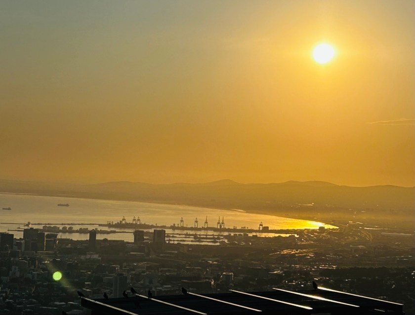
Sunrise over the harbour from the top of Table Mountain — the city waking up below, and two birds who clearly have season tickets to this show.
June 2024. One trip, one big loop: Cape Town to the Garden Route, up to Victoria Falls, through Johannesburg, and finishing in the bush at Madikwe. I have been to Africa before — Rwanda, a bridge, a million smiles — and I told myself I knew what to expect. I did not. South Africa is not one country in the way most countries are one country. It is several worlds taking turns in the same landscape, and just when you think you have it figured out, it hands you a waterfall that soaks you to the skin and a lion that looks straight through you. But I am getting ahead of myself — boots on the ground first, opinions after. That has always been the rule.
First, some general information — what on Earth is this place?
Where: the southern tip of Africa, bordered by Namibia, Botswana and Zimbabwe to the north, Mozambique and Eswatini to the east, and two oceans — the cold Atlantic on the west, the warm Indian Ocean on the east. It is one of very few countries with another entire country inside it: Lesotho sits landlocked in its middle like a polite surprise.
Size and people: roughly 1.2 million square kilometres and about 62 million people, the overwhelming majority of them warmer than the weather, which in June is saying something.
Capitals: not one, not two, but three. Pretoria runs the government, Cape Town hosts Parliament, Bloemfontein handles the judiciary. Even the capitals job-share.
Languages: twelve official ones — eleven spoken languages including isiZulu, isiXhosa, Afrikaans and English, plus South African Sign Language, added in 2023. English will get you everywhere; a smile gets you further.
Money and time: the rand (ZAR), and South African Standard Time, UTC+2, all year round. No daylight-saving nonsense. A country after my own project-controls heart — the schedule is the schedule. And a word that will matter later: in June 2024 the rate sat near 18 rand to the US dollar, which means the dollar goes a long way in South Africa — uncomfortably long, if you enjoy wine. Hold that thought until Stellenbosch.
When we went: June is winter. In Cape Town that means the rainy season, green hills and a mountain that plays hide and seek with the clouds. In the interior and the bush it is the dry season — cold mornings, golden grass, and animals gathering at the waterholes because there is nowhere else to drink. Timing, as always in life and in projects, is everything.
And the name you will hear everywhere: the Rainbow Nation, an expression coined by Archbishop Desmond Tutu and carried around the world by Nelson Mandela. Spend even a week there and you stop hearing it as a slogan. It is a description — of the people, the languages, the food, the music in a minibus taxi at a traffic light — and also, if I am honest, an aspiration the country is still working on, in full public view. More on that shortly, because you cannot write about South Africa and skip its history. Well, you can. Many do. I am not going to.
The history you walk through, whether you planned to or not
The short version, because the long version fills libraries. The Dutch East India Company landed at the Cape in 1652 and built a refreshment station for ships. Refreshment stations, like scope creep, have a way of becoming permanent. Colonisation followed, then the British, then gold and diamonds, and in 1913 the Natives Land Act restricted Black South Africans to roughly seven per cent of the land — their own land, in their own country. In 1948 the National Party made racial separation the formal law of the land and gave it a name: apartheid. The Group Areas Act sorted people into neighbourhoods by race. Pass laws controlled where Black South Africans could live, work and walk. The Bantu Education Act set out, deliberately, to prepare Black children for little more than servitude. When people protested at Sharpeville in 1960, police killed 69 of them. When schoolchildren in Soweto marched in 1976 against being taught in Afrikaans, the police shot them too, and the photographs went around the world.
I visited the sites, because reading about it at home and standing in it are two different educations. Robben Island, out in the cold Atlantic off Cape Town, is where Nelson Mandela spent 18 of his 27 years in prison, breaking rocks in a limestone quarry and somehow coming out the other side preaching reconciliation instead of revenge. The tours today are led by former political prisoners — men who were held in those same cells, telling you what the cell was like, in the first person. There is no narration on earth that competes with that. District Six, back in Cape Town, is quieter and in some ways harder: a vibrant, mixed, musical neighbourhood declared “white” in 1966, its more than 60,000 residents forcibly removed and their homes bulldozed. Much of it still sits there, grass and empty streets, a gap in the middle of a beautiful city, like a tooth nobody replaced.
Mandela walked free on 11 February 1990. In April 1994, South Africans of every race voted together for the first time, in queues that stretched for kilometres and were, by every account, the happiest queues in human history. He became president, served one term, and handed over power like a man returning a borrowed ladder. The Truth and Reconciliation Commission, chaired by Tutu, then did something almost no country has had the nerve to do: it put the wounds on the table, on television, in public, roughly 22,000 testimonies of them, on the theory that a nation, like a project in trouble, cannot recover what it refuses to look at honestly. I spend my working life in project controls. I know a lessons-learned exercise when I see one. That was the bravest one ever run.
Is it finished, healed, sorted? No. The inequality is visible, the politics are noisy, and South Africans will tell you so themselves, loudly, with jokes, usually within ten minutes of meeting you. But the direction of travel was set by people who chose the harder right over the easier revenge, and you feel that choice everywhere — in the people especially. The beauty of the Rainbow Nation is not that it is a rainbow. It is that it is a rainbow still being built, by hand, daily, with humour. Now — the lighter stuff, before I get emotional and ruin my reputation.
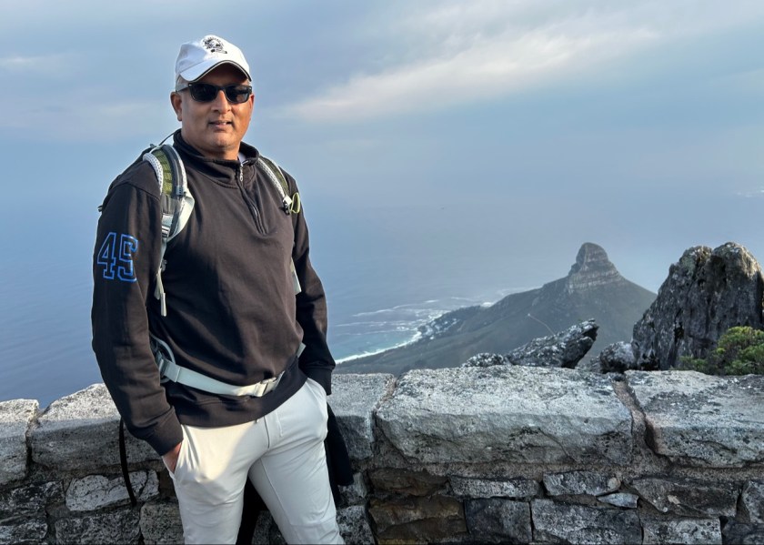
Proof of summit. Lion’s Head behind me, Cape Town below, and one Plannosaurus trying to look casual at 1,085 metres.
Cape Town — the city with a mountain for a roof
Cape Town does not so much have a view as it is one. Table Mountain stands over it at about 1,085 metres, flat as a dining table and older than the Himalayas, and the city arranges itself politely in the bowl beneath it. We went up early on the morning of 17 June, and the mountain gave us a sunrise I am still thinking about — the harbour below turning gold, the city waking up in miniature, a pair of birds sitting on the ledge beside us watching it all like two locals who have seen this show ten thousand times and still turn up. The cableway cars rotate as they climb, so everybody gets every view and nobody gets to hog the window. Good design. Equitable, democratic, very South African. I approved — and I almost never approve of machinery before coffee.
From the top you can pick out Lion’s Head, the 669-metre peak next door that does look, with a little goodwill, like a lion lying down watching the Atlantic. Robben Island sits out in the bay, small and flat and easy to miss if you did not know. Knowing is the whole point of going.
And then, because no Cape Town account of mine would be honest without it: the bunny chow. Bunny chow is Durban’s gift to the world — a hollowed-out loaf of white bread filled to surrendering point with curry, invented by the city’s Indian community in the 1940s as a portable lunch, edible container and all, and containing, despite the name, precisely no bunny. Cape Town serves it proudly, and I ordered one the way I order most things in a new city: confidently, and without asking the only question that mattered, which was how hot. The answer arrived. Tears were induced — I am not too proud to print that. Steam, I am fairly certain, exited through every available orifice, some of which I did not know were rated for steam. The bread conducted a heroic rescue operation, bite by bite, and I finished it anyway, because it was magnificent. South Africa’s Indian community seasoned that loaf under some of the harshest decades in the country’s history and still produced joy in bread form. Remember that the next time somebody tells you food is just food.
Stellenbosch and the Cape of Good Hope — wine, gables and the end of the map
Stellenbosch, founded in 1679 and the second-oldest town in the country, is what happens when Cape Dutch gables, oak trees and very serious wine all move into the same postcode. Vineyards run up to the mountains in green rows so straight they would satisfy a scheduler. The wines need no publicity from me — the world already knows — but I will say this: a tasting room in the Winelands, winter sun, mountains doing their best impression of a wine label, is a persuasive argument for never checking your email again. I resisted. Mostly.
And now the exchange rate enters the story, grinning. At roughly 18 rand to the dollar, a full tasting flight at a serious Stellenbosch estate — several wines, a beautiful room, a mountain view thrown in free — came to less than the price of a single glass in many American wine bars, and the bottles I carried away cost what I would pay for an unremarkable Tuesday bottle at home. I am a project-controls man; I live by budgets, baselines and the sacred discipline of never gold-plating scope. In the Winelands I gold-plated. If you visit with a strong currency, my advice is to decide your wine budget in advance, in writing, in the presence of witnesses, because the rand will talk you out of your principles one glorious tasting at a time.
The Cape of Good Hope, down the Peninsula, is where the map starts running out. Bartolomeu Dias rounded it in 1488, Vasco da Gama followed in 1497, and for centuries it was the great crossroads of the sea route to the East. Two things to get right, because I got both wrong until I stood there: it is not the southernmost tip of Africa — that honour belongs to Cape Agulhas, about 150 kilometres away — and the two oceans do not officially shake hands here, whatever the gift shops imply. What it is, is wild: cliffs, fynbos scrub full of plants found nowhere else on Earth, baboons with the confidence of small landlords, and wind with a personal grudge. The Flying Dutchman funicular takes you up to the old lighthouse, which I used without a shred of guilt. I have climbed enough mountains voluntarily; the knees file their grievances in writing these days.
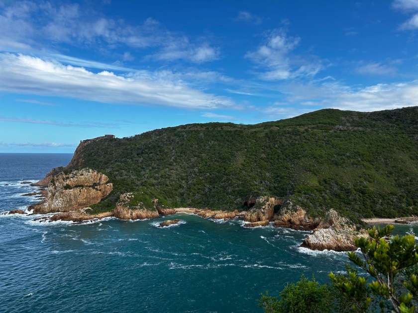
The Garden Route doing its impression of paradise — green headland, white water, and the warm Indian Ocean pretending it behaves like this every day.
The Garden Route and George — 300 kilometres of showing off
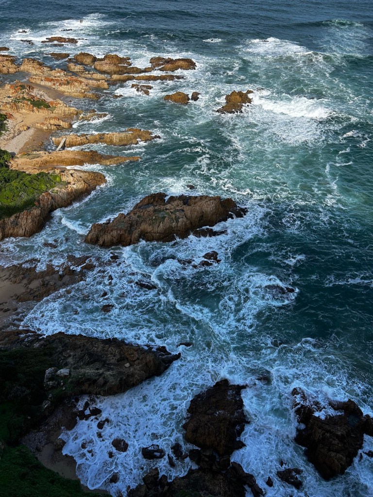
From Cape Town we turned east onto the Garden Route, roughly 300 kilometres of coastline from Mossel Bay to the Storms River that manages to fit in lagoons, forests, cliffs and beaches like it is trying to win an argument. The photographs do the talking here: an emerald headland with the Indian Ocean — the warm one, the sensible one — breaking white against the rocks below, and surf hammering into coves in a way that makes you very glad to be watching from above with both feet on dry land and a railing nearby.
George, the route’s main town, was proclaimed in 1811 and named for King George III, which tells you the naming committee was not overthinking things that year. What George has, beyond the name, is the Outeniqua Mountains standing over it like a green wall, some of the finest golf country anywhere (I behaved myself; the clubs stayed home), and the feeling of a town that knows it lives somewhere beautiful and has decided not to make a fuss about it. The Garden Route generally works like that. Knysna’s lagoon and oysters get the fame, Tsitsikamma’s forests and suspension bridges get the adrenaline, and the whole road gets driven far too fast by people in a hurry to arrive — a mistake. This is a stretch of Earth that rewards the slow schedule. Float, as we say in my line of work, is not wasted time. Sometimes float is the whole point.
The surf at full volume. The Garden Route is gentle in the brochures; the rocks down there tell a different story.
Victoria Falls — the Smoke That Thunders, and yes, you get wet
After George we flew north to Zimbabwe and the Zambezi. The local name for Victoria Falls is Mosi-oa-Tunya — The Smoke That Thunders — and I want to state for the record that it is the most honest piece of tourism branding on the planet. David Livingstone arrived in 1855 and named the falls for Queen Victoria, which was the fashion of the time; the smoke and the thunder were already there and did not require naming.
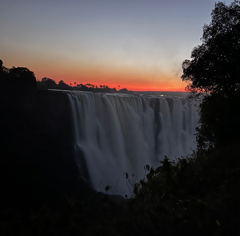
The numbers first, because numbers are my love language: about 1,708 metres wide and 108 metres high, the largest single sheet of falling water on Earth. We went at dawn on 21 June, just after the wet-season peak, which means the river was still running near full theatre. The sky burned orange behind the spray, the mist rose above the gorge like — well, like smoke, thundering. You hear it before you see it, and you feel it in your chest shortly after.
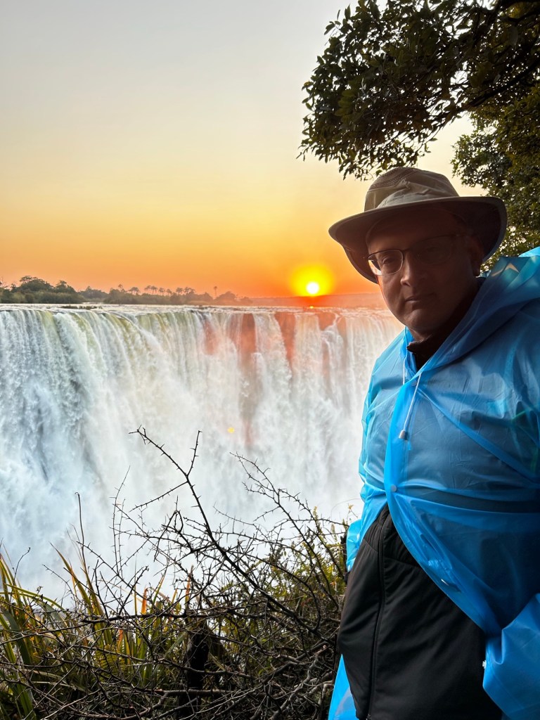
And then there is the poncho. At the entrance they issue you a rain poncho, and a first-timer makes the mistake of thinking this is a cheerful souvenir. It is not. It is a formal warning. The falls manufacture their own weather — the spray comes up out of the gorge and comes down again as rain with momentum — and within ten minutes of the viewpoints I was wearing the blue poncho like a man who had lost an argument with a car wash. Do as I say in the tips below, not as I did in the photographs. The camera survived; the dignity was declared a write-off somewhere around viewpoint nine. Worth it. Completely, entirely worth it. Stand there at sunrise, soaked, laughing, listening to a mile-wide river throw itself off a cliff, and try to think about your inbox. You will fail. That failure is the product being sold, and it is underpriced.
Mosi-oa-Tunya at sunrise, 21 June — the Smoke That Thunders, with the sky still on fire behind it. A mile of river, mid-leap.The blue poncho is not a souvenir. It is a formal warning. Ten minutes later I understood the Falls’ weather system personally.
Johannesburg — the city of gold, with a long memory
Johannesburg exists because of gold, found in 1886, and everything about the place still moves at the speed of a man who thinks he might get rich by Friday. It is the country’s biggest city and its economic engine, and it does not do quaint. What it does do, seriously and well, is memory. The Apartheid Museum, opened in 2001, starts by handing you a ticket that randomly classifies you as white or non-white and sends you through separate entrances — you understand the system in your stomach before you read a single panel, which is exactly the idea. Out in Soweto, Vilakazi Street holds a distinction no other street on Earth can claim: it was home to two Nobel Peace Prize winners, Mandela and Tutu. One street. Two Nobel laureates. People still live their ordinary lives along it, which is the most Soweto thing imaginable — history there is not under glass, it is doing the school run.
And then, because I am who I am, a word for the Wanderers. Cricket people call the old ground the Bullring, for the noise and the hostility of its crowd when the South Africans are on top — I have called it surreal before, and I stand by it. Every cricket nation has a fortress; this one barks. Standing in that city, with that history under your shoes and that stadium in your ear, you understand South Africans a little better: this is a people that holds its sorrows and its sport with the same two hands, firmly, and does not drop either.
Madikwe and Tau — where the animals hold the schedule
The finale: Madikwe Game Reserve, some 75,000 hectares of bush in the North West province, up against the Botswana border. Madikwe is a remarkable story in itself — farmland converted back to wilderness from 1991, restocked under Operation Phoenix, one of the largest game relocation programmes ever attempted, which moved more than 8,000 animals in. It is malaria-free, it holds the Big Five, and because cheetahs and wild dogs live there too, the local tally runs to a “Super Seven”, which is either excellent ecology or very good marketing, and I choose to believe both.
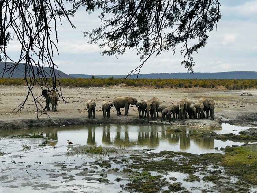
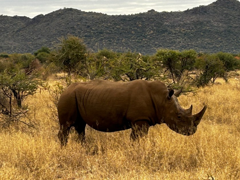
We stayed at Tau Game Lodge, in the Groot Marico country, overlooking its waterhole. Tau, for the record, is the Setswana word for lion — truth in advertising, as you will see. A lodge waterhole, properly run, is the finest theatre seat in Africa: you drink your coffee, and the programme arrives on its own four legs. Over our days there the waterhole and the drives delivered an elephant herd with calves lined up at the water like a family at a buffet, a rhino standing in grass the colour of ripe wheat doing absolutely nothing at a stately pace, two young elephants working off their opinions on each other, and a giraffe performing the full origami routine required for a tall animal to reach a low drink.
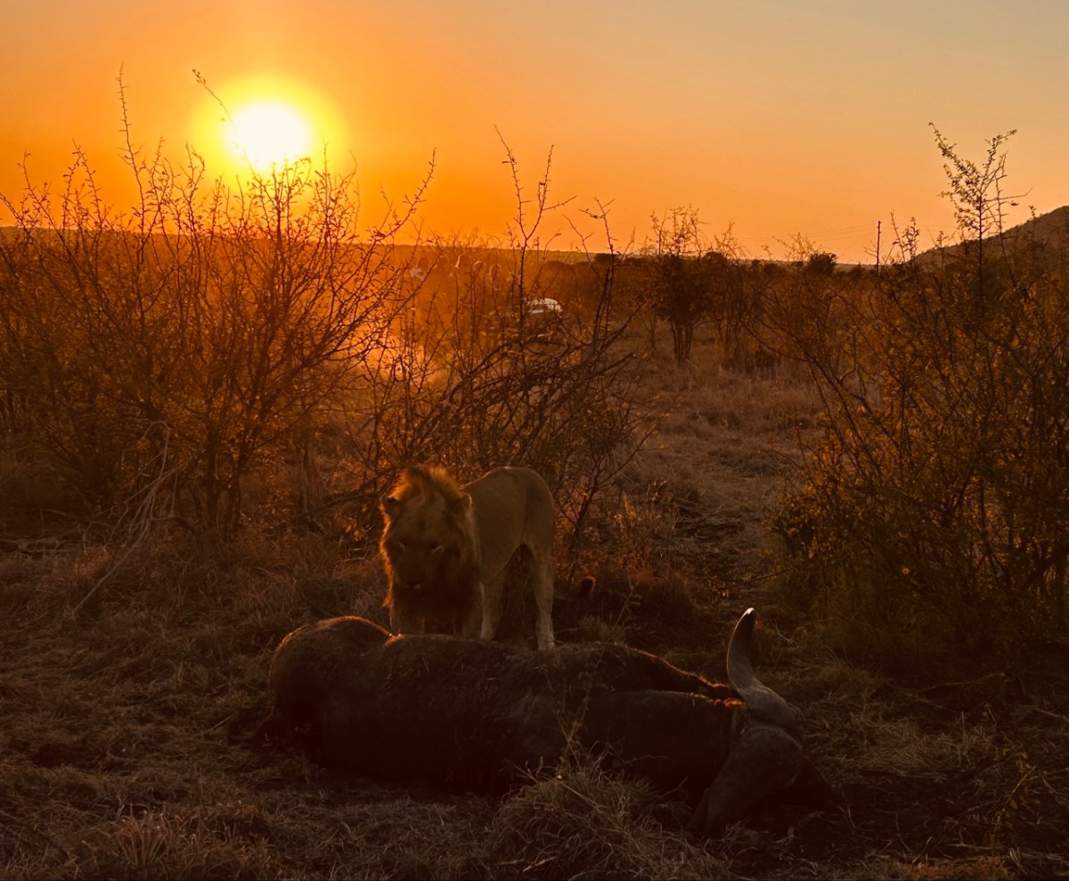
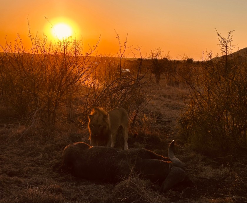
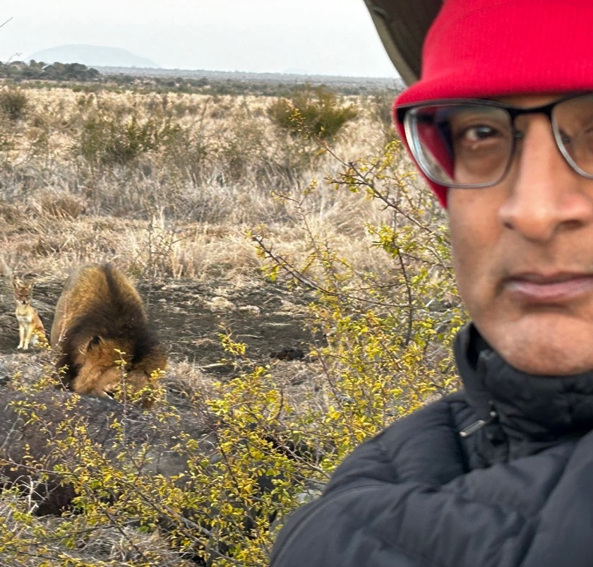
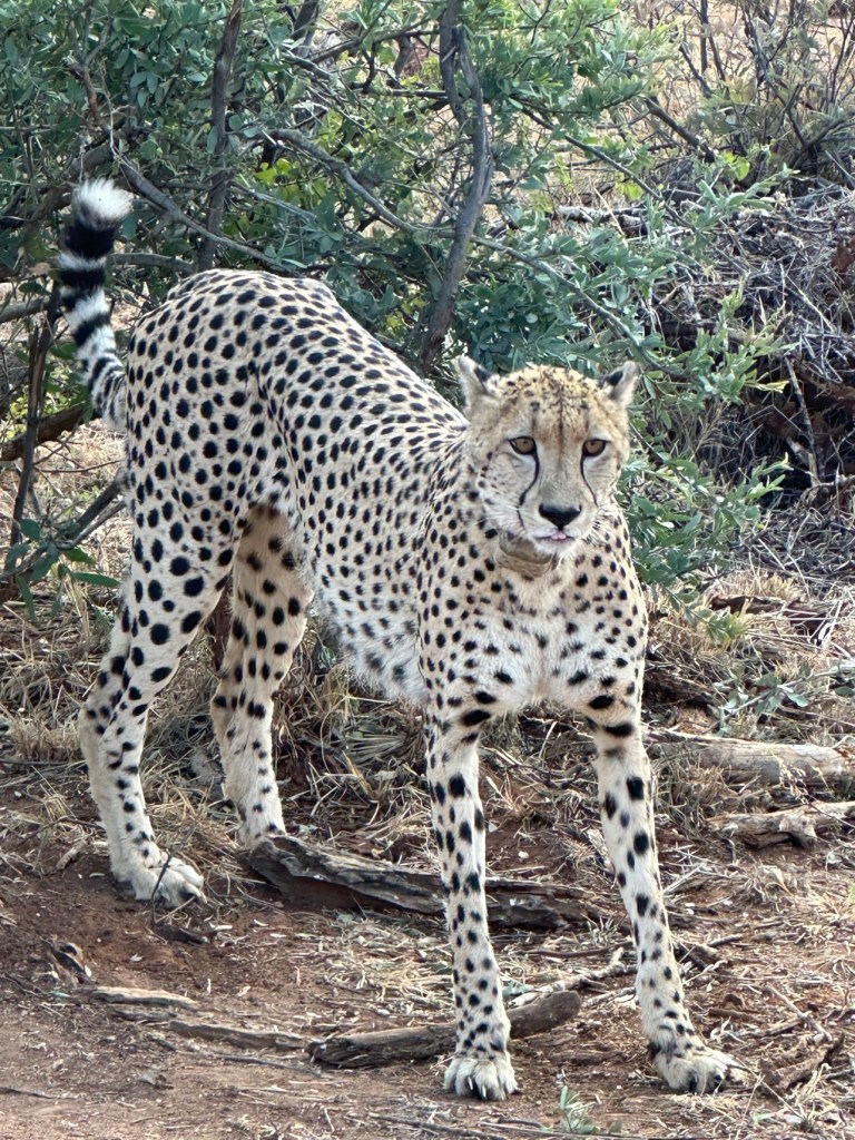
But Madikwe runs on the animals’ schedule, not the lodge’s, and the drives are where it proves it. On the evening of 22 June we found a lion standing over a buffalo carcass at sunset — an enormous animal, the day’s work done, in no hurry whatsoever — and the next morning, very early, the same neighbourhood gave us the photograph I will be showing people until they stop inviting me to dinner: me, red beanie, morning face, in the foreground; behind me, entirely unbothered, a lion stretched out in the grass; and behind him, sitting up like he had bought a ticket, a black-backed jackal. Photobombed by a jackal, at dawn, in the presence of a lion. There are worse reviews of a holiday. The lion later yawned directly at my camera with the air of a senior executive closing a meeting, and a cheetah — spotted, elegant, wearing a tracking collar and zero interest in us — stood in the bush and stared through the vehicle like we were furniture. She was right to. In Madikwe you are not the main event. That is precisely the event.
The king, standing over a buffalo carcass at sunset on 22 June. His land, his dinner, his schedule. We were just the audience.Red beanie, morning face — and behind me, a lion at rest and a jackal who had clearly bought a ticket. Photobombed in the bush. Zero regrets.The whole family at the Tau waterhole, calves and all, lined up in order of seniority. Best seats in Africa come with coffee.She looked through our vehicle like it was furniture, and honestly, she had a point. A Madikwe cheetah, collared, calm, and entirely in charge.A rhino in grass the colour of ripe wheat, doing nothing at a stately pace. Some animals pose. This one presided.
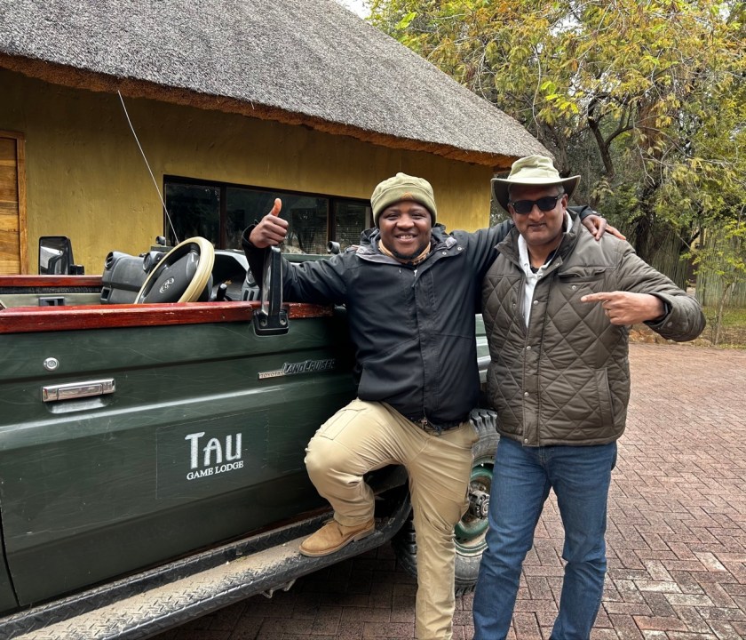
Which brings me to Silas. Every safari is, in the end, only as good as its ranger, and ours was Silas — the man in my farewell photograph, arm over my shoulder, thumb up, both of us grinning beside the Tau Land Cruiser like a doubles team that had just won something. Rangers like Silas are the real infrastructure of a place like Madikwe: tracking at dawn, reading the ground like a newspaper, knowing which lion is which and which elephant is having a day. My entire profession is built on the belief that experienced people on the ground beat any plan, process or tool you can buy. Madikwe is that belief with better scenery. Where animals roam free, as I wrote when I posted the photographs at the time, the sun is bright and the vibes are positive. I was leaving with lasting memories — beautiful Africa. I still am, a year and more later, writing this.
Silas the ranger and yours truly, farewell morning at Tau — “Tau” means lion, and this man finds them. Leaving with lasting memories. Beautiful Africa.
Travel tips, from a man who learned some of them the wet way
Timing: June is a sweet spot with split personality — pack layers for Cape Town’s winter rain and Madikwe’s frosty dawn drives alike. The red beanie in my photographs is not a fashion statement. It is a survival tool.
Victoria Falls: take the poncho, wear the poncho, and put everything you love in a sealed dry bag. Visit at dawn for the light and the smaller crowds. The spray is not a risk; it is a certainty.
Table Mountain: go early, and book the cableway ahead. The mountain makes its own cloud (locals call it the tablecloth) and shuts the show down without consulting you.
Safari: trust your ranger, sit still, be quiet, and let the bush come to you. Bring more memory cards than pride — the jackal does not do retakes.
Driving the Garden Route: do not rush it. The road is the destination wearing a very good disguise.
Everywhere: greet people properly, learn three words of the local language, and accept that South African time is a relationship, not a deadline. Coming from a project-controls man, that is not a complaint. It is field research.
South Africa did not feel like one trip. It felt like five — a mountain city, a wine country, a waterfall that rains upwards, a gold city with a conscience, and a wilderness that politely ignores you — stitched together by people who have been through the worst of what humans do to each other and decided, publicly and on the record, to build the opposite. The Rainbow Nation is not a finished product. It is a work in progress, executed with humour, by hand, in twelve official languages.
I have not seen the last of it. It has not seen the last of me either.
Hamba kahle, South Africa — go well. Tatenda, Zimbabwe — thank you. Until the next time the boots hit the ground.
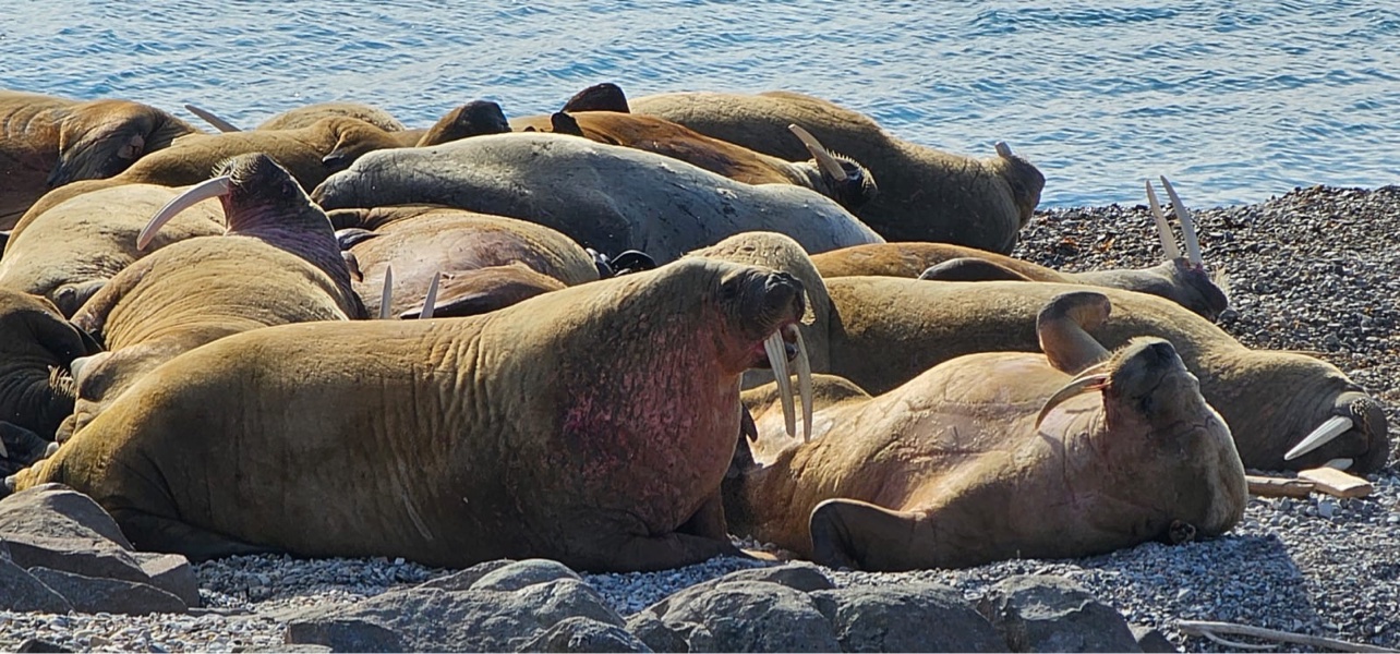
The walruses — a pile of snoring uncles after a big lunch, all on one sofa. Move over, you are on my flipper.
You can watch all the documentaries you want, nod sagely, and say “yes, the Arctic, very far, very cold.”
Nonsense! Unless you get your own boots on the ground — or boots on the ice — you have no idea.
In July 2025 I was cruising the Arctic with a few good people, reveling in geology, geography, marine zoology and good old fashioned fun. I did not plan for how small this semi-skilled Plannosaurus from Maryland would feel at 78 degrees north — and then, gloriously, to 82 degrees.
82 degrees, folks. Let that sink in. My ears certainly did.
First, some general information — where on Earth is this place?
Before the funny stuff, the geography lesson I actually paid attention to — because with Svalbard, the geography is the story.
Svalbard is a Norwegian archipelago in the Arctic Ocean, about midway between mainland Norway and the North Pole. The name means “cold coasts” in Old Norse, which is honest branding if ever I heard it.
Quick facts, in my blog style:
Where: 74° to 81° north latitude, 10° to 35° east. The largest island is Spitsbergen.
Main town: Longyearbyen, on Spitsbergen — the world’s northernmost town of its size, home to about 2,400–2,500 people from around 50 countries.
Status: The Svalbard Treaty of 1920 recognises Norwegian sovereignty, and the Svalbard Act of 1925 made it part of the Kingdom of Norway. Unusually, citizens of treaty countries can live and work there — a free economic and demilitarised zone, right up at the top of the world.
Getting there: Fly into Svalbard Airport, Longyearbyen (LYR) from Oslo — about 3 hours — or from Tromsø. No roads connect the settlements; it’s boats in summer, snowmobiles in winter, and aircraft otherwise.
Land and light: About 60% is covered by glaciers, with mountains, fjords and permafrost for most of the rest. Midnight sun runs from late April to late August; polar night, when the sun never rises, from late October to mid-February.
Practical basics: Currency is the Norwegian krone (NOK), the language is Norwegian with English widely spoken, and Longyearbyen started as a coal-mining town, named for American John Munro Longyear.
Now, the proximity point — the one that stopped me in my tracks. Longyearbyen sits at 78.22°N, only about 1,300 km (800 miles) from the North Pole. Read that again. It is closer to the Pole than it is to Oslo, and roughly 950–1,000 km north of mainland Norway itself. You are not in Gaithersburg anymore.
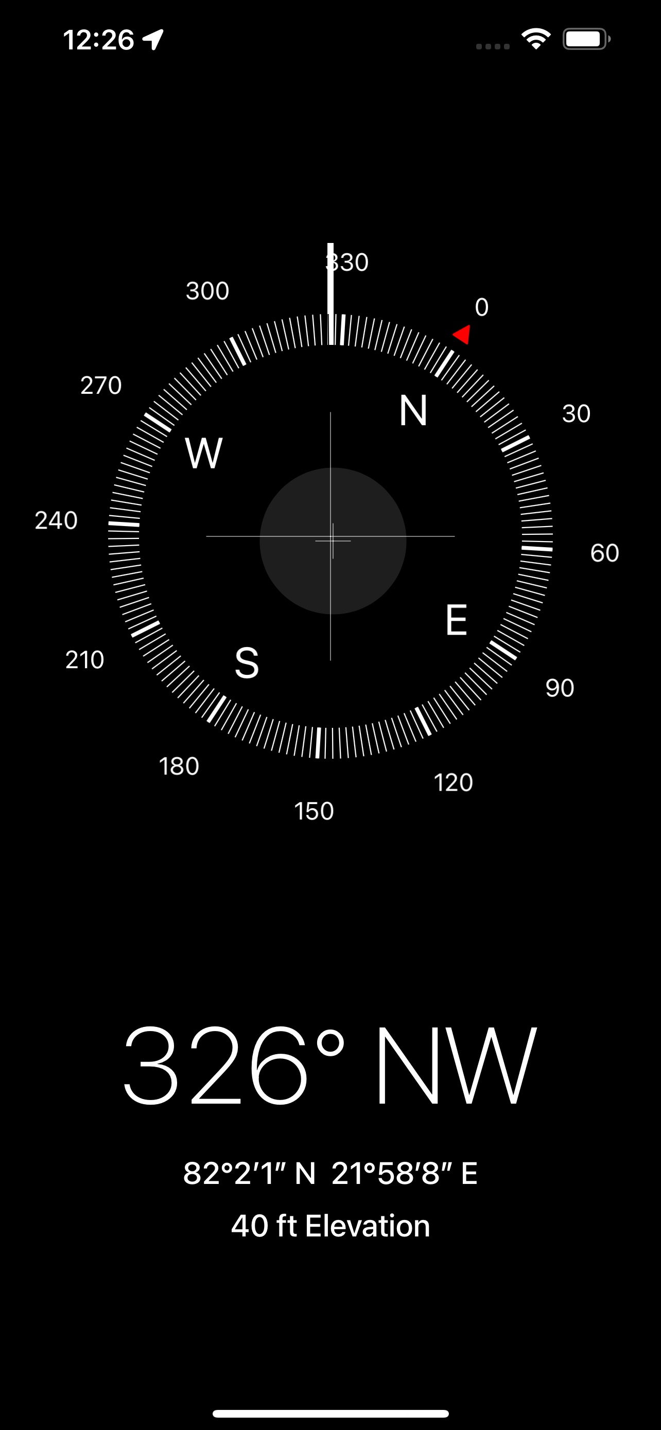
And our cruise went beyond even that: from 78° to 82° latitude, pushing toward the pack ice — into the white silence where the only schedule that matters is the ice. I have the screenshot to prove it: 82°2’1″ N, 21°58’8″ E, at 40 ft elevation. Eighty-two degrees, folks. I checked it three times, in case my frozen fingers had invented it.
Proof, not bragging — well, a little bragging. 82°2’1″ N. My phone did the maths, I just held it and tried not to freeze.
The cruise — not a race, and thank God for that
Our home was the World Voyager with Atlas Ocean Voyages — a proper expedition ship, not a floating shopping mall.
Days fell into a rhythm I wish life followed. Wake up. Look out. Gasp a little. Layer up like an onion that has read too many safety briefings. Get in the Zodiac. Listen to people who know what a moraine is.
Layering up deserves its own paragraph. Base layer, fleece, insulation, windproof outer, hat, gloves, boots — by the end I looked like the Michelin Man had mated with a walking duvet. I tried to look cool, expedition-leader cool. I failed comprehensively. Wrestling with zips, gloves eating my gloves, and I — a man legendary for gluing his own knees to the floor while tiling and for heroic ineptitude with an impact wrench — was now entrusted with four zips and a life jacket. Nothing exploded. Growth.
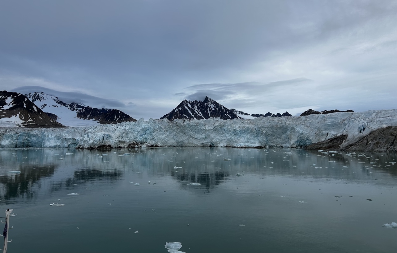
Geology, geography, marine zoology — on paper, a syllabus. Out there, theatre. Glaciers in steel-grey water, fjords so still you feel rude talking too loudly.
A wall of ice, doing absolutely nothing, very impressively — theatre, not a syllabus. I kept my voice down. It felt rude to talk too loudly.
I learned this on the Tour de Mont Blanc and in the Grand Canyon: by day three you realise this is not a race. Slow down. Actually see it. Svalbard taught it again, colder.
Wildlife has the right of way here — as it should
Start with the walruses — they started my camera roll and stole the show.
A large group hauled out together on a rocky shore — a heaving, whiskered, utterly unbothered pile of blubber and tusks. Think snoring uncles after a very big lunch, all piled onto one sofa, all convinced the other fellow is taking up too much room. Snorting, shuffling, giving each other a look that said “move over, you are on my flipper.” Magnificent and ridiculous, and I mean that with love. You do not rush a walrus. You sit, you watch, you grin like a child.
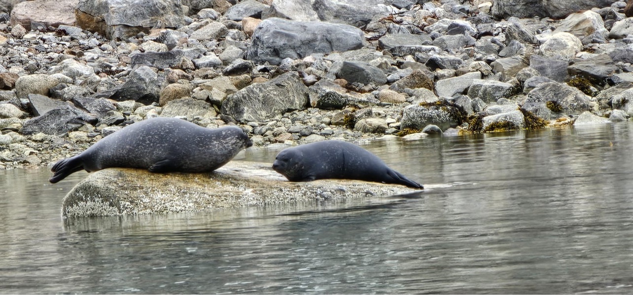
Seals too — and not a fleeting glimpse, either. Two of them, hauled out and resting on a flat rock at the water’s edge, nose to nose, like they were in deep conversation and we were very much not invited. I know that look. Serious matters were being discussed. Fish, probably. Or us.
Nose to nose, deep in conversation — I did not interrupt. Fish, probably. Or a full review of my layering technique.
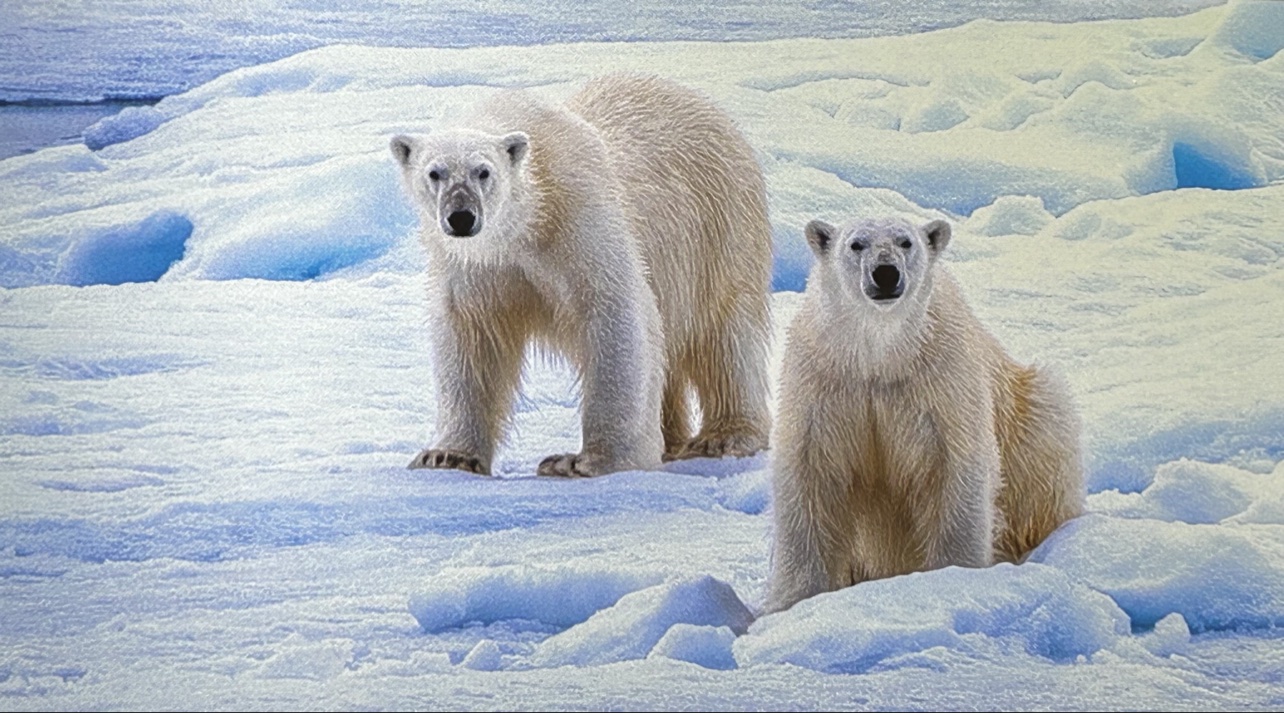
And then — the polar bears. And yes, we saw them. Really saw them.
Two bears, out on the sea ice. Both of them looking straight at us. Straight at the camera. No binocular squinting, no white-on-white guessing game, no “was that a rock?” — just two magnificent, utterly unbothered bears giving us the full stare. I stopped joking. I stopped fiddling with zips. Awe does that. For a minute, this Plannosaurus just stood there and took it in, properly grateful and properly small.
Two of them. On the ice. Both looking straight at us — I stopped joking for once. They were here first, and they knew it.
That stare is exactly why every landing is shaped the way it is. You scan the shore. Your guides scan the shore. The warning signs at the edge of Longyearbyen say it plainly: this applies to all of Svalbard. You do not wander out of town alone, or without a guide and proper protection. Not bravado. Not optional. The bear was here long before our ship.
Reindeer wander through Longyearbyen like they own the place, because they were here first. Smaller, stockier, completely unfazed by yet another photo. Traffic stops. Nobody honks. Frankly, a reindeer has more right of way, more local respect, and a better sense of direction in town than I do. I accepted this demotion gracefully.
Up the valley sits the Svalbard Global Seed Vault, carved into the permafrost. Over 1.4 million seed samples are stored there — a backup for the world’s food crops, humanity’s spare hard drive in case we mess up the original. Visitors do not go inside — you see the iconic entrance, that wedge of concrete and light in the mountain — and that makes it more powerful. Some vaults are not meant for tourists.
Small customs matter, too. You take your shoes off indoors — homes, hotels, many public places. Partly practical, partly respect. I managed this without gluing anything to the floor, which, given my domestic record, is practically a qualification.
In July, the midnight sun. It circles, dips, thinks about setting, and changes its mind. At 2 a.m. it is light. Is it dinner? Bedtime? A second morning? I lost the argument about sleep every night, happily, with the sun outside doing laps like it had nowhere better to be.
Some fun facts & FAQs
Can you adopt a polar bear? No. You cannot adopt one, take one home, or pose next to one for a selfie. I checked — homeowners association, airline baggage allowance, explaining a polar bear in the garden to the neighbours — it fails at every stage. Admire from a respectful distance, with a guide, and be grateful it stayed respectful.
Is a walrus an emotional support animal? No. I know. I was disappointed too. A walrus needs its rocky shore, its fellow snoring uncles, and about two tonnes of personal space. Take the photo, leave the walrus exactly where it was — on someone else’s flipper.
Is it cold in July? Yes. The Arctic in July, not the Algarve. Layers, windproof outer, boots, hat, gloves. Brown skin burns in the sun — as I have said on hotter hikes — and it also gets wind-whipped and frozen at 80°N. My ears filed a grievance on day one. Gear is not vanity, it is planning. And planning still happens between the ears — preferably ears that are still attached and warm.
Can you just walk out of Longyearbyen for a stroll? No. Past those warning signs is polar bear territory. Go with a guide with protection, or do not go. Full stop.
Do people actually live there all year? Yes — scientists, miners, teachers, kids. Ordinary people, extraordinary life. Respect.
Can you go inside the Seed Vault? No. See the entrance, learn the story, and leave the seeds waiting for a day we hope never comes.
What surprised you most? The silence. And walrus breath at close-ish quarters. Both stay with you.
Travel tips — from a man who learned them the hard way
Go in summer if wildlife is the point. July gave us 24-hour light, open water, walruses hauled out, seals and birds — and a ship that could push to the pack ice.
Dress in layers, then add one more. Base, insulation, windproof outer. Comfortable standing still on deck for an hour? You are dressed right. Look ridiculous? You are definitely dressed right.
Listen to the expedition team. Every briefing. The talk you think you can skip makes the next landing make sense.
Respect the boundaries. Stay with the group, behind the guide, quiet near wildlife. The best photo did not disturb the animal.
Give Longyearbyen proper time. Walk the town, see the reindeer, stand under that polar bear sign — and stop there.
Pack patience. Ice and wind write the itinerary, not the brochure. Float is not a luxury in the Arctic; it is survival. Build contingency, smile, carry on.
Take your shoes off indoors. Small thing, big respect.
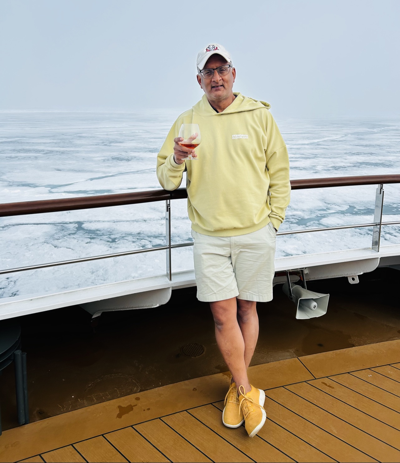
And now, in the interests of full disclosure: the man who has just preached layers at you for several paragraphs was photographed on deck in shorts, trainers and a yellow hoodie, holding a glass, with pack ice stretching out behind the ship. Do as I say, not as I do. On deck. Briefly. Very briefly. My ears filed their grievance all over again, and they were right to.
Do as I say on layers, not as I do on deck — shorts, trainers, a glass in hand, pack ice behind me. In my defence, I went straight back inside.
Svalbard felt like being let in, briefly and on strict terms, to a world that does not need us at all — and is more beautiful for it.
If you get the chance, go. Go slowly, go prepared, go humble. And go with a decent hat. Your ears will thank you.
Ha det bra, Svalbard — thank you, and goodbye for now. You have not seen the last of me.
The journey to the edge of the world sure sounds ominous but it couldn’t be farther from the truth. The journey that took me right to the southern most region of the world was fairly uneventful but the sheer excitement of touching a southern latitude was sufficient fodder for the travel bug within me. Hard to say if I am bitten by that travel bug or contaminated with it. The past few months would seem to suggest the latter.
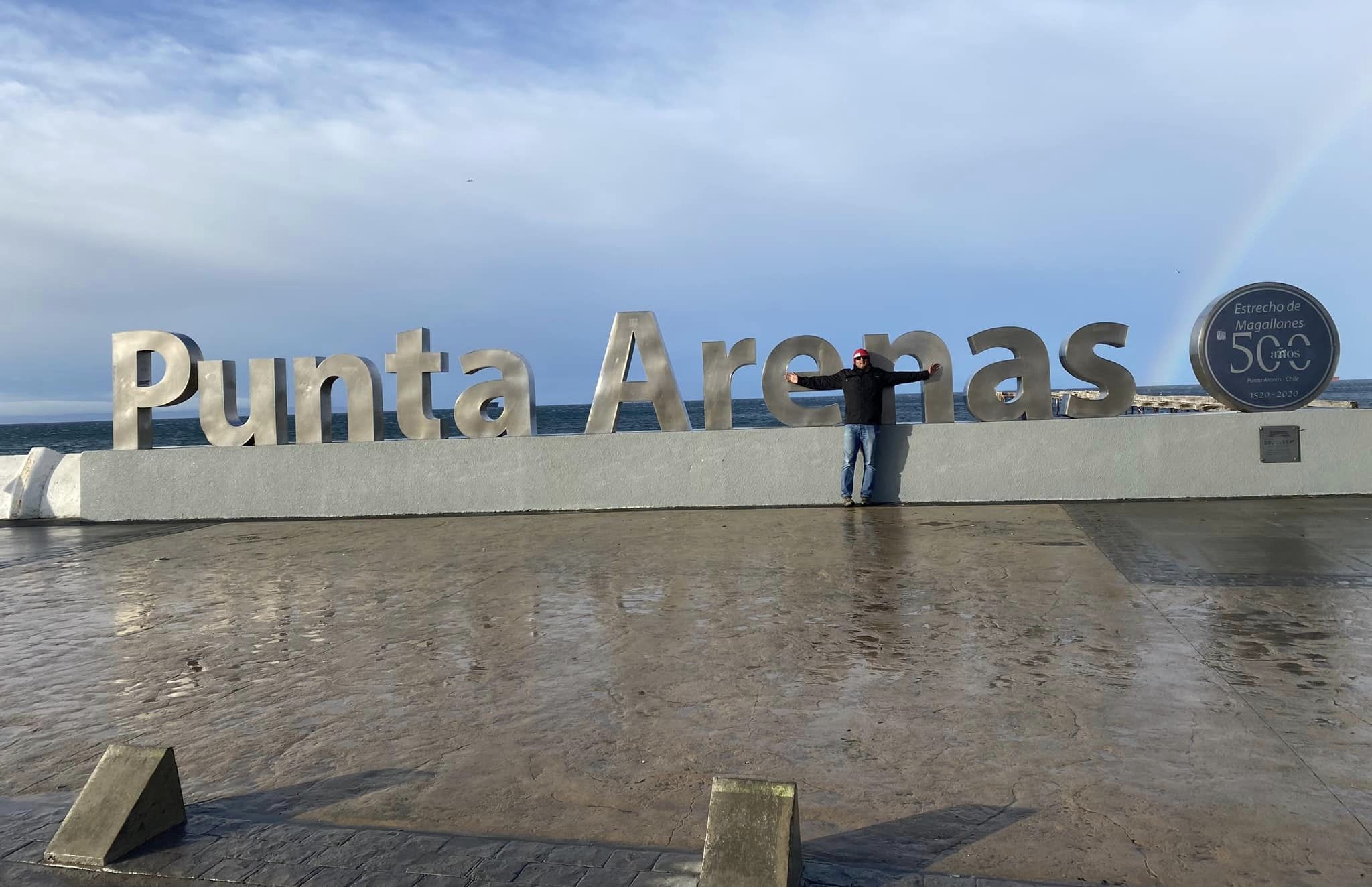
Anyway, for those geographically inclined, given the North and south poles are at 90 degree latitude and as far as the northern hemisphere goes, you could go almost upto 85 degree on land . South is different, vastly different and by the time you are around 55 degrees there is no land between that latitude (southern tip of the American continent) and the Antarctica peninsula. And imagine my delight to know the Hotel I stayed in Punta Arenas (one of the three most southern cities in the world) was right next door to the old post office. This is the place where Robert Falco Scott, the British Naval officer sent off 400 letters to several people announcing he was back safe after discovering the Antarctic peninsula. That was in 1904. Several years later in 1911 he lost the race to the South Pole to the Norwegian, Roald Amundsen and the journey ended with his death. I am told they were not all that prepared and even their sled dogs couldn’t take it.
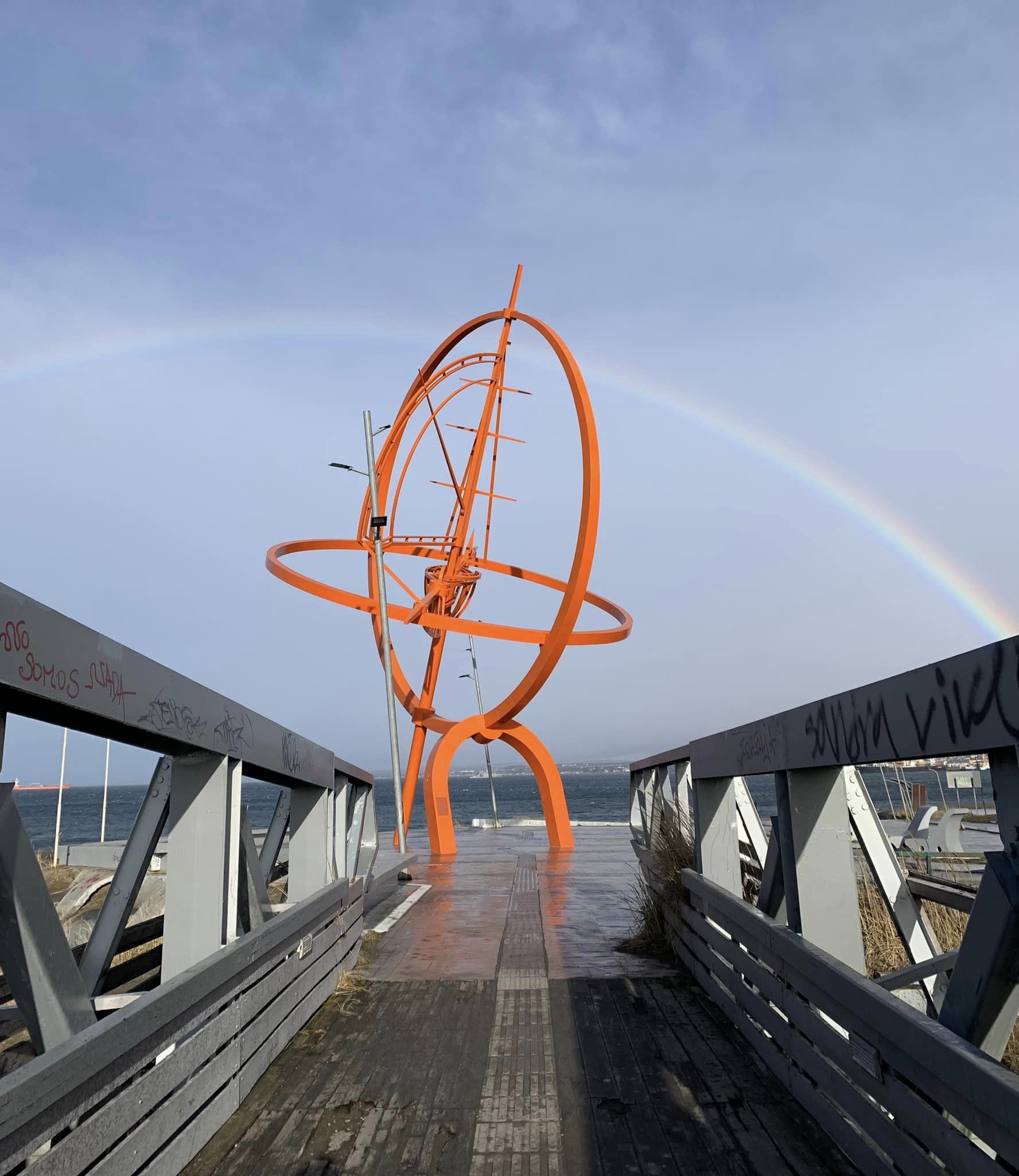
What am I doing here? Punta Arenas is the city right by the Magellan Strait. He was Ferdinand Magellan almost the first person to circumvent the globe and its been 500 years since he found that route that connects the Atlantic to the Pacific. The town is all his for sure; and when you consider the intrepid explorers that chose this path to go to lands unknown, traversing the angry seas and this one did prove that the earth was not flat; contrary to popular belief at that time. That must have been quite a voyage. Originally from Portugal, he managed to upset his masters so much so that they pressed criminal charges against him. He somehow managed to get to Spain where the King was magnanimous enough to sponsor his trip to discover the elusive passage to Asia. The year is 1518- After a route starting from Lisbon and heading south along the west coast of Africa the ships head west towards Brazil and Argentina. Between countless spells of intrigue, treachery, betrayal and other such shenanigans they find the strait. What a momentous occasion it must been and hardly did he know he’d have towns, streets, GPS and even the small penguins named after him. I know a few people that we can have weasels named after them. So after he crosses over to the pacific side him and his entourage get to Philippines to their way to Malacca which was supposed to be their eventual destination. Magellan gets into a scuffle with one of the local tribes and gets killed and with him his ambition of being the first person to circumnavigate ethe globe lies 50 feet deep in the Pacific. His second in command, Juan Sebastian Elcano manages to reach Spain three years after they set sail. The year is 1521.
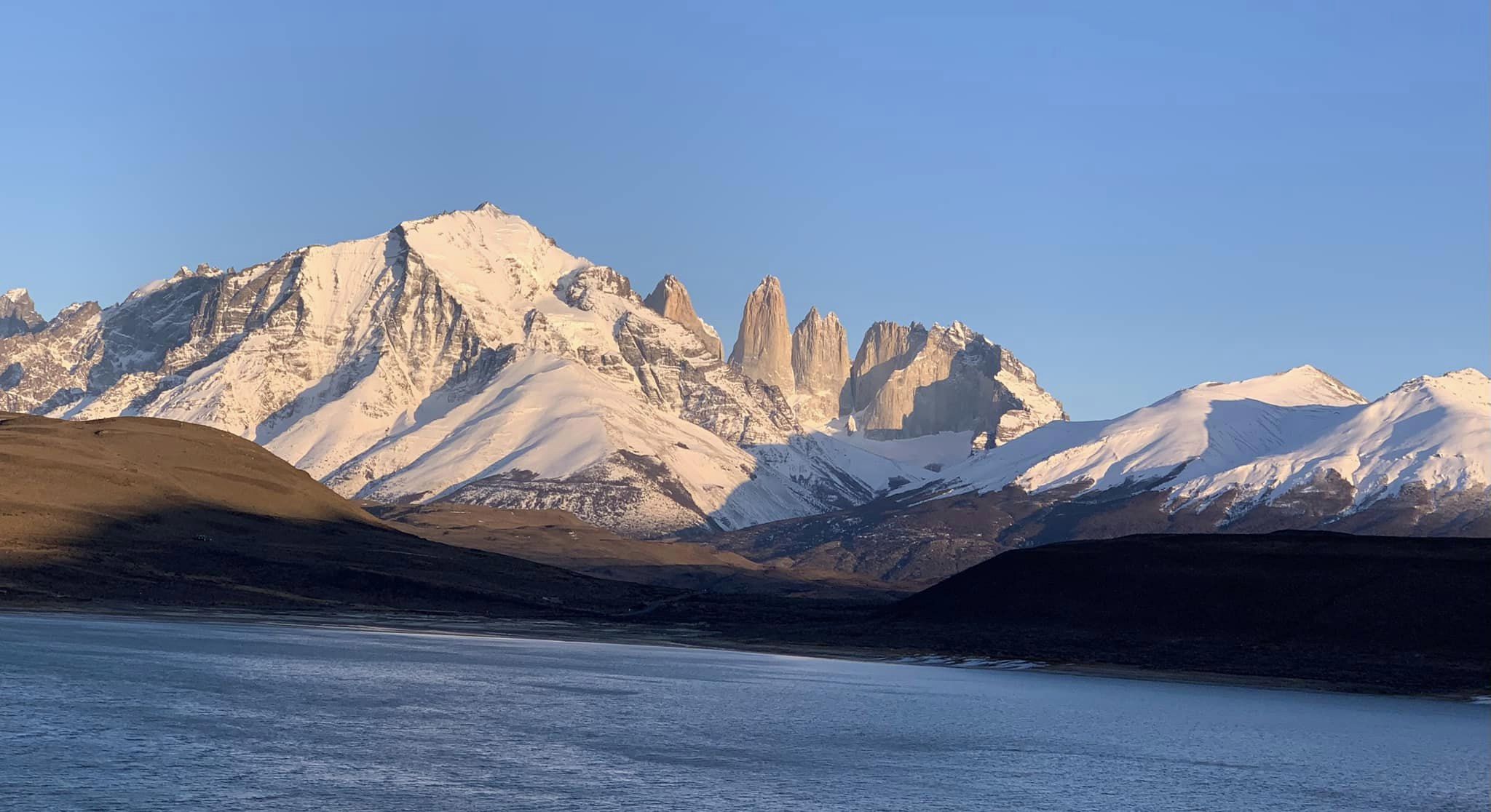
The gateway to the Torres del Paine national park is on a route that heads north from Punta Arenas towards the city of Puerto Natales. The trip to the Torres del Paine is just over 90 mins from there and once you’re in that region, you could be on the moon. Secluded and majestic in its appearance its all about the blues. Blue skies, blue waters, blue hued glaciers and Paine actually means blue. Chile and Argentina are so co-joined here and you could literally be on the Argentine side in less than an hour.
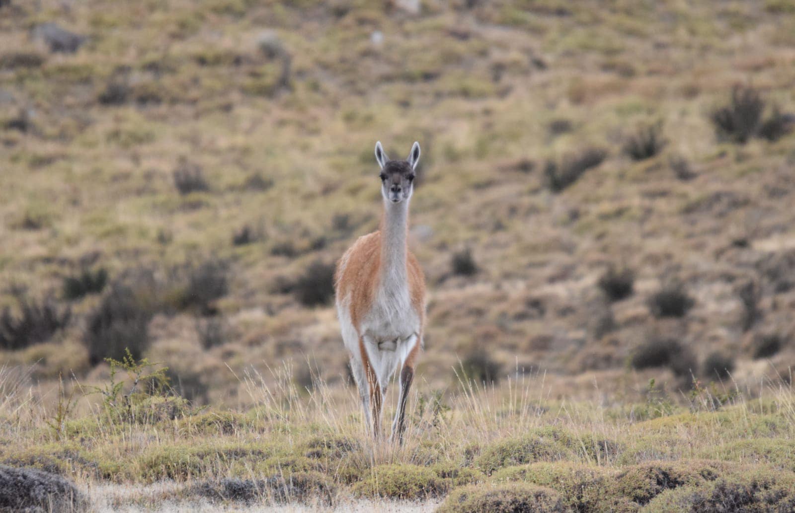
Its home to the largest count of the Puma. Puma- What a cat – sits on top of the food chain here and he’s got plenty of Guanacos to feed on. Guanacos, part of the camel family are wild and love being in a herd. The Puma is a loner, he is more of a cat than a lion. He doesn’t roar, he meows and loves to eat, sleep , rest and repeat (Some of you may be able to relate to him and it certainly sounds like me on a weekend!)
I was fortunate enough to get sightings of the Puma and a herd of Guanacos and the picture perfect landscapes of the region are as close as you’d get to see unpolluted , virgin surroundings untouched by civilization. Sight of a broken piece of an iceberg made the day even better.
Missed seeing the Magellanic penguins- The penguins migrate to the Isla Magdalena , close to Punta Arenas starting in Sep. They usually hang out around the Atlantic and make the two month journey to get to the place for breeding. Interestingly they do this journey every year and create quite a ruckus on the island. Perhaps later this year, these penguins get the opportunity to see me. Much like the gorillas in Rwanda.
Some fun facts & FAQs-
Penguins may walk funny they are monogamous and stay loyal to their partner their entire life
No- They don’t serve Penguin soup at restaurants there
You cannot adopt a Puma. They bite and they are highly carnivorous
Pumas are not considered an emotional support animal and the airlines do not allow them to travel on your flight.
Guanacos are fast runners but usually end up on the Puma’s dinner plate because simply put, Pumas run faster.
The entire Patagonia has less Spanish speakers than Miami
The wind velocity at the Magellan Strait is enough to carry you away to unknown destinations
Travel tips-
Fly to Puerto Natales directly from Santiago, Chile if you are in for the Torres. If you want to be part of Magellan’s city, you’d better fly into Punta Arenas. You could always do a multi city trip. And the Bus Sur that run between Punta Arenas and Puerto Natales on the Ruta de final de mundo (Route to the end of the world) are absolutely the best way to get around.
The end of summer was just about the perfect time to get into Iceland. With the pandemic having parked us all within the confines of home and WFH, travel was at first a luxury but for a globe trotter it became a necessity.
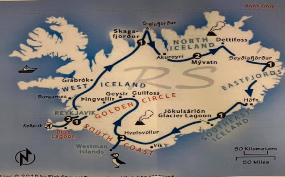
Picking Iceland was easy. I had been there before for a brief bit and always dreamt of taking a comprehensive tour so it was what we embarked on. From doing a comprehensive research of things to do before and during the trip to actually embarking on this Arctic adventure it was all quite an adventure. It wasn’t backpacking, it wasn’t taking tours and it wasn’t about going there to click photographs of the magnificent landscape, but it was about driving around the ring road of Iceland anti-clockwise moving always, stopping for hikes while taking in those spectacular images of fire, water and ice. I’d call this a “Carpacking” adventure.
The route shown above plus the Snaefellsnes peninsula on the west
So check out all those travel pre-reqs-
Get your COVID testing done 72 hours before you arrive- PCR or Antigen, either will do. Remember to pre register on the Iceland government website to get a bar code before you get on the plane (travel.covid.is). Also make sure to carry your vaccination certs. And lastly book your COVID test appointment on the same website and schedule it such a way that you can have that done 72 hours prior to your scheduled arrival. Costs 50 Euros for a PCR and 30 euros for the Antogen test. One more thing, carry your own booze and water bottles. Iceland is wonderful but you don’t want to be found short of these commodities while on your trip.
We found the best way to follow our ambitious route was rent a car from the Keflavik airport. The off we go. We had to cover so much ground. And also while the distances are miniscule compared to North American standard, speed limits are low and fines are very punitive. You could be driving at 90 kmph before you suddenly realize the speed limit is down to 70 before getting down to 30.
Day 1– Straight from the airport heading east along the south coast- The Golden circle that had the Thingvellir National park, The Geysir (The Strokkur was especially a miniature version of Old faithful but erupted almost every 4-5 minutes accompanied by the ooohs and aahs). Next was the awesomely spectacular Gullfoss. Then the trip on Route 35 to the Kerid Crater. Spent the night in Selfoss- An uplifting town of 8000 right by the river.
Thingvellir- Home of the continental tectonic plates
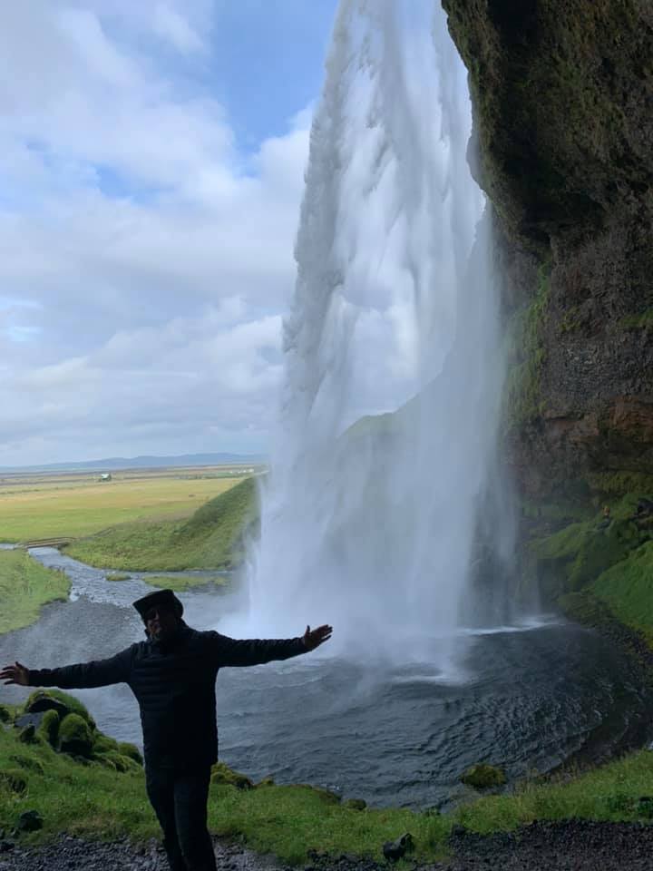
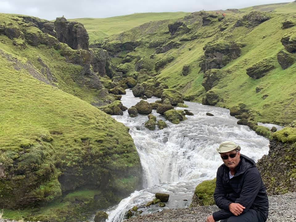
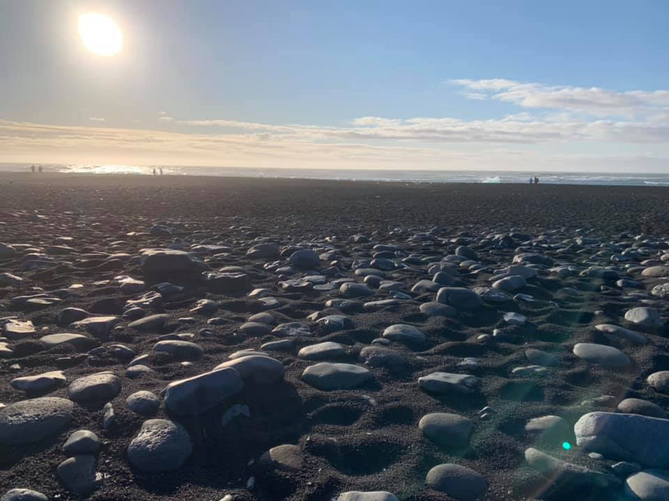
Day 2– Long day. Headed along the south cost on Route 1 making our way south east. So much to do, so much to hike so much to cover. Seljalandsfoss (Where you could actually hike up and behind the falls). There are two other falls in the vicinity and one of the falls is hidden inside a cave. Feels like a dream. Next stop was Skogafoss where the climb upto the top was a great cardio workout followed by another hike two other falls. And just when we thought we had our workout for trhe day, driving along the south coast we took a left to check out the Sólheimajökull glacier . Well the walk turned out be an amazing hike, where the volcanic rocks dust the icebergs giving it an eerie look. A must do. What we did next , well we shouldn’t have. A flat monotonous walk from the car park to see the DC plane wreck (2 miles one way) by the ocean. Avoid this if you have other things to do. But before we went down to Hofn (stop over for trhe night), we had to go see that treacherous sinister looking Reynisfjara. Having been there before and experienced the sneaky waves, do not turn your back to the water for too long. Its enthralling! Wanted to do the glacier lagoon and the Diamond beach but just ran out of time and it was almost 10.00 when we settled in for the night in Hofn. Hofn is a small fishing village facing the Ocean on the south east.
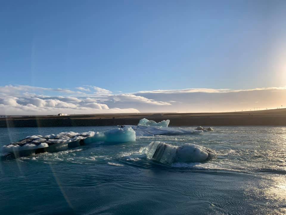
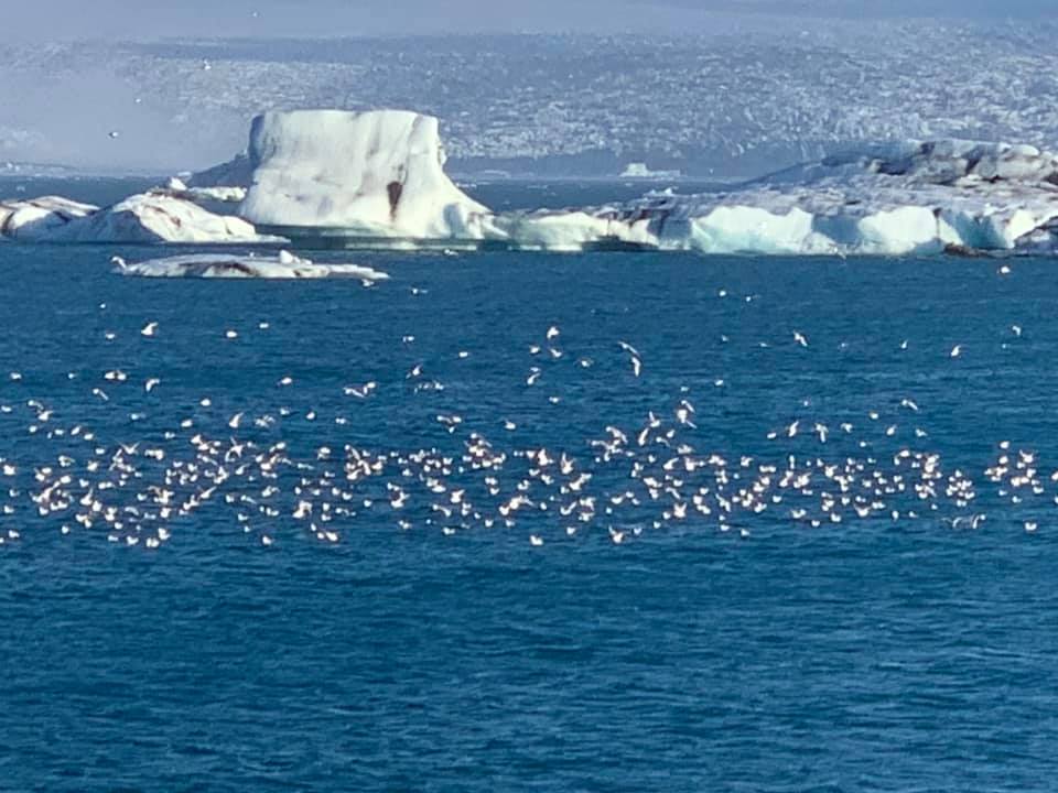
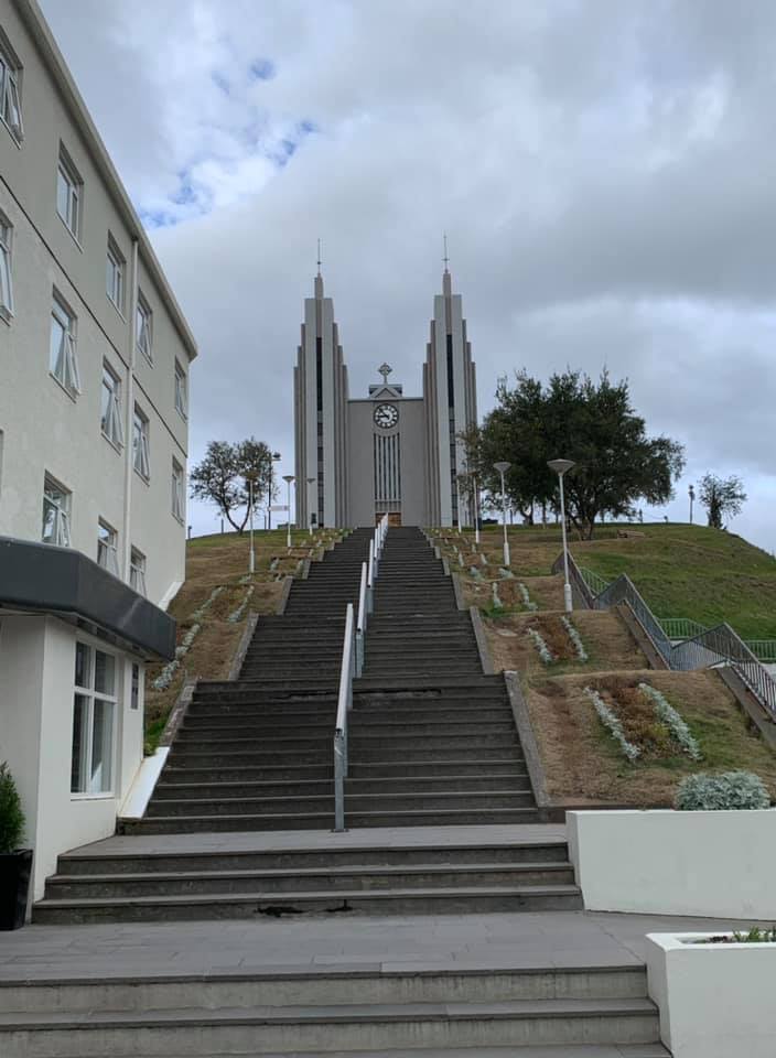
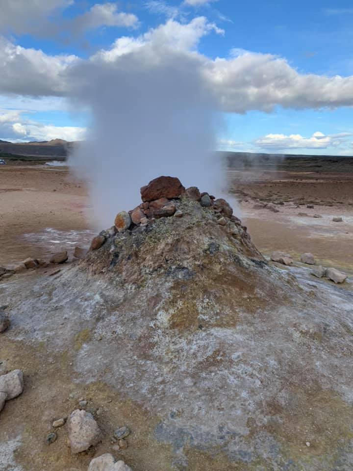
Day 3– Headed back east on Route 1 to get to The Glacier lagoon and Diamond Beach. While it added 100 miles to the trip, it was worth every mile. The Vatnajökull glacier occupies 10% of Iceland and as ice chunks breakaway flowing it to the Ocean. The lagoon had these mini icebergs floating accompanied by some prancing seals. Just across is the Diamond Beach where the ocean carves these icebergs into magnificent ice sculptures and when the sun shines upon these, these truly look like diamonds. Then the journey took us along the eastern fjords, with a small town at the mouth of every fjord. Its all on route 1 and our drive took us to the North. Diamond Circle as its known that has the Dettifoss (very silty, angry waterfall) and the Godofoss (Awe inspiring Waterfall of the Gods where statues of Viking Gods were thrown in when Christianity pervaded the country in the 12th century. Interspersed between these falls was the geothermal fields that has everything you could dream of- Bubbling mud pools, steaming mini volcanoes, mini geysers and the place smells strongly of a high school chemistry lab with all that suphurous gases. The night was spent in the second largest city , Akureyri, a town of 18000, right on the Eyjafjörður fjord. Loved the city and even the clouds cleared enabling us to go on a night adventure to chase the Aurora Borealis. It was perfect timing, away from the city lights and watching the spectacle of the green show in the sky. This was just truly fortuitous.
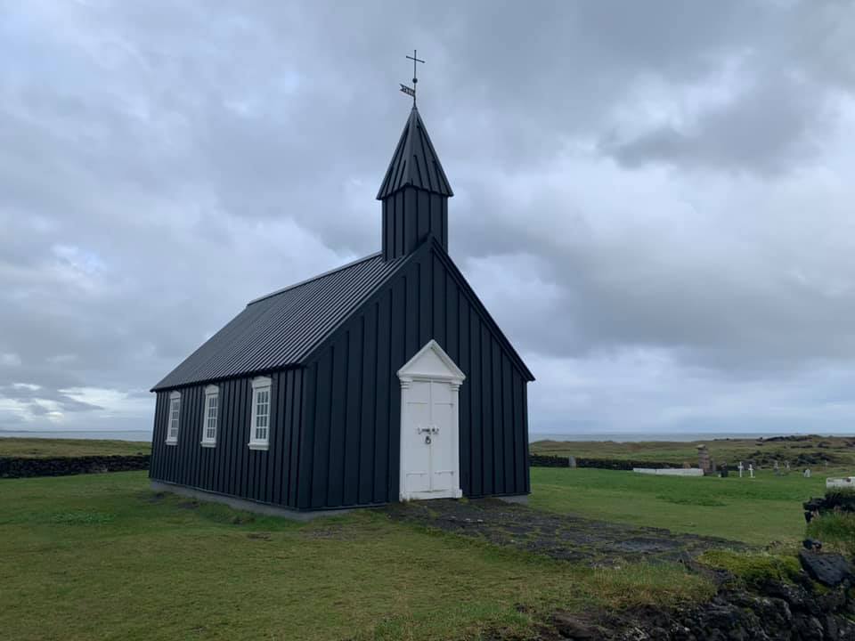
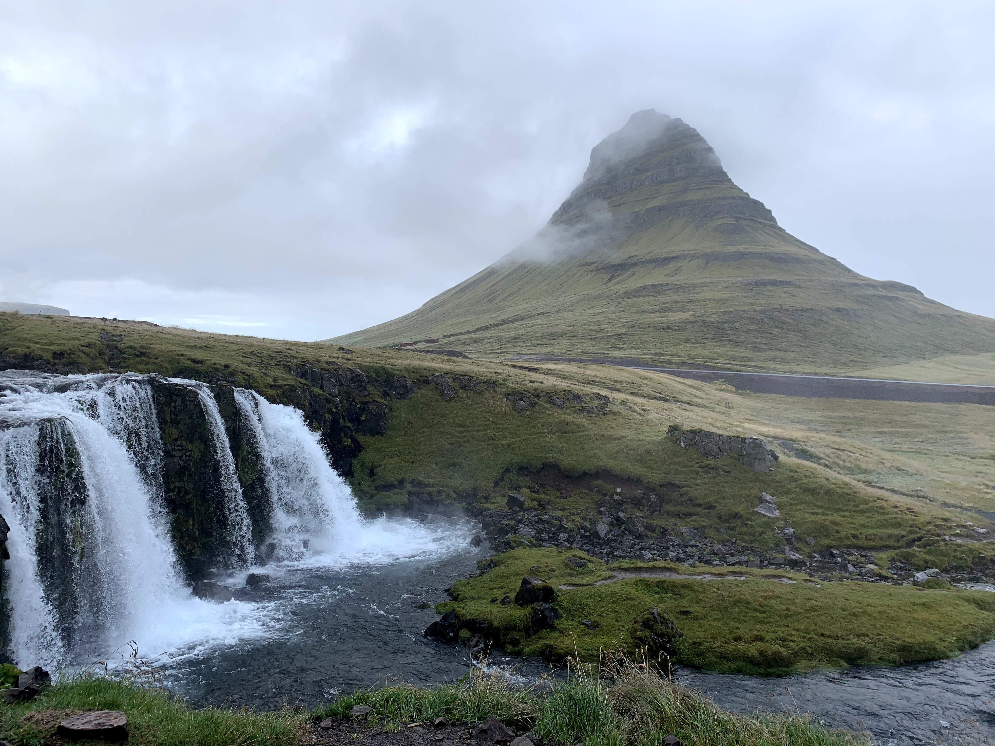
Day 4– In case it wasn’t mentioned before, the gas stations with their kiosks – N1 and Olis are life savers. Great Cappucinos, good eats and well, gas is expensive (almost $7 per gallon). So this day was about driving west from Akureyi to the Snaefelles peninsula. Stop overs at Hvaamstangi to catch the seals but lucked out and saw a whale too in the bay. This country keeps getting better. And entering the peninsula on Route 54, it was just another ooh-aah drive. The town of Grundarfjörður was the gateway to one of the most symmetrical and gorgeous mountain with a waterfall in the forefront- Kirkjufell. A must do. Then driving along the peninsula visiting the old black church in the hamlet of Búðir before taking it “easy” at the Langaholt. So much had been accomplished.
Day 5– This was the day of the west cost along Route 1. From the peninsula to Reyjavik for the COVID test. Good stops on the way with the Goudberg cliffs (free standing basalt rocks), Borganes (picturesque and good place to get gas) then heading down to Arkanes and catch the lighthouses before getting into the capital Reykjavik. Plenty to do, not least the Hallgrímskirkja church situated at the top of the hill overlooking the pretty downtown strewn with cafes, shops and bars. The COVID test was a breeze and I could only marvel at the efficiency of the lab. It was a conveyor belt and got my test results within 6 hours!
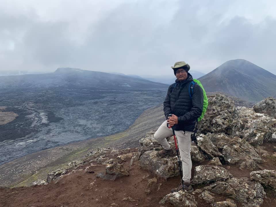
Day 6– This was the day when we got to hike up 1000 feet to be at the site of the active volcano, Fagradalsfjall. This volcano that hadn’t erupted in 800 years started to spew lava and the rivers of fire flowed in 2021. When we went up there , the lava wasn’t flowing but what we saw was awe inspiring. The blackened frozen lava from 6 days ago and the view of the crater from across the valley stood up on the peak. Dreams can become real. After this hike, the blue lagoon reckoned that was quite touristy and then the anti-climactic lunch at the Fridheimar greenhouse tomato farm. I’d say just okay but good for the novelty.
Day 7– Departure day. Good duty free at Keflavik . Iceland- I may be back- yet again!
My journey through turbulence of WW2 and the cold war- Germany/Poland
Europe- Germany- Poland just saying these in the same sentence seems like someone’s about to embark upon a tale of World War II. And that’s what exactly I did- heading on a trail that took me from the end of the World War 1 to the end of the cold war.
The trip culminated in decades of reading, watching , vicariously living that era in Desutcheland and eastern Europe. It was a childlike delights being able to see, touch and feel the streets, the buildings, the landmarks and being able to sense it in person. While the journey evoked a massive amount of sadness within me as I felt the evil doings of the Nazis and how one human could possibly do things to another.
My days in Berlin took me to the famous glass dome of the Reichstag- The German parliament building where the plenary chambers were completely wiped out in the fire of 1933, months after the Nazis came to power. It wasn’t used during the third Reich and in fact it did not open up for operations until 1999. With its slogan “Dem Deutschen Volken” and some graffiti made by the marauding Red Army in 1945, it’s a symbol, a monument of unified Germany overlooking the Brandenburg Gate. (Tip- Please make reservation online a few weeks prior to the visit. While its free, it fills up quick.)
The Brandenberg Gate is that absolute symbol of the end of the Cold war, the wall collapse and of course the stage for the third Reich powerful parades. As a reference the gate was in the neutral zone of the Berlin Wall. The Reichstag was on the west side of Berlin. As I stood there, it took me all but a few moments to get transported to that era when the place was cold, surrounded by barbed wire, an inner wall and then looking into west Berlin. Parisian Platz is an absolute joy to be in shouldered by the famous Hotel Aldon, where Hitler infamously made the Czech leader wait an eternity before deigning to meet him and then screaming at him causing the Czech to faint.
TIP- Public transport was one of the best I have ever been, The Berlin Welkom card for zones BC enables you to unlimited travel on the trams, buses, S-Bahn and the U-Bahn.
The pedestrian crossing signs in the east Berlin side has that guy in a hat and its different from the signs West Berlin. The guy in the hat was how it was during the East Germany (DDR times). Its endearing!
I walked over to checkpoint Charlie- Site of many a spy novel and thrillers. Its almost overwhelming to be standing there again letting the mind work its magic. The walk on Wilhelmstrasse then the turn into Zimmestrasse and Niederkirchnerstrasse is to feel the grim silence of the cold war. A short walk from there takes you to the memorial of the Jews which again takes you to some heart wrenching stories from people that perished from the holocaust.
The second day for me in Berlin was a travel through the darkness of the Topography of Terror museum which stands on grounds of the SS and Gestapo headquarters and it truly shakes you up when you walk around reading about the horrors inflicted upon the Jews, Sinti and Roma gypsies and the homosexuals, mentally challenged and the site plans were finalized for the “Final Solution”. There was this great exhibit on the Warsaw uprising that brought a stark reality to the travails of Poland and how Warsaw was razed to the ground inspite of the brave underground Poles that resisted the Wehrmacht.
Then this amazing thing Germans have done is to preserve several of these memories of extreme horror; a means to acknowledge the crimes but mostly to make future generations aware of how dark that era was. My journey took me to one of the main concrete bunkers built near the Alhalter station, famous for harboring several thousands of German civilians during the Allied bombings in 1945.
And as I started my day I decided to hop over to the East side gallery- where a good section of the Berlin wall is intact and has enabled graffiti artists to express the cold war and freedom in many forms. Then a visit to the Cecilienhof palace in nearby Potsdam, where the Big 3- UK, US and Soviets signed the Potsdam Agreement that set the course for post war Germany and Poland. It was just surreal being in the exact same room where Churchill/Attlee, Truman and Stalin sat in July 1945 and signed off on the agreement. The palace grounds are a pure joy to wander around and the town of Potsdam is just charming. On the way back from Potsdam, I had go and feel for myself the infamous Gleis 17 (Platform 17) at Berlin Grunewald station where thousands of Jews were transported by rail to the infamous death camps east- Auschwitz-Birkenau, Belzec and other. Makes you shiver in fright, as I stood at the desolate abandoned platform.
The next day took me to me one of the earlier concentration camps, just outside Berlin that housed political prisoners and barracks that were later used by the Soviets- Sachsenhausen. Its hard to explain the emotions as you go through the prison cells, wait, close your eyes and feel the morose ambiance.
The journey across the border from Berlin Lichtenberg to Krakow, Poland was shrouded in thought and sadness making my way to the death and I chose to take the rail. While the medieval of Krakow was a happy place to partake in the local Polish cuisine – A mouth watering recipe of the Polish summer hunter’s stew consisting of Kielbasa pork and cabbage followed by a delicious serving of pirogis. A visit to the 13th century Wieliczka Salt Mine was more of a distraction but was an enriching experience nonetheless. (Tip- Do not attempt to do the Salt mine and Auschwitz-Birkenau the same day. The Polish Zloty goes a long way and stands at 4 to $1 USD. Use Uber liberally in Krakow).
The last day in Europe was all about Auschwitz and Auschwitz-II (Birkenau)- A very emotional experience and from the time you enter the camp gate with that sinister sign “Arbeit macht frei” meaning “Work will set you free” makes you shiver. A sign that symbolizes persecution, horror and death. The tour takes you into the camp barracks built by slave prisoner, the horrid living conditions and that prisoner hierarchy that had the Jews at the absolute bottom. Unspeakable emotions envelop you as you walk into the infamous Barrack # 11, the place of torture, execution style killings and a short walk away from the basement that served as the first Gas chamber. The very mention of the gas chambers and Zyklon B crystals is nerve wracking as you start to imagine thousands of women and children being told they’re being led to the showers for a thorough rinse. Mass murder, crimes against humanity, deep anger builds up. The short journey to Birkenau that has that evil symbol of the camp gate seen from the offloading ramp of the rail carriages. Where thousands and thousands of Jew and others were offloaded and led to their deaths; hard to even pen down the grisly experience.
HOW CAN HUMANS DO THIS TO ONE ANOTHER? EVEN BESTIALITY DOESN’T BEGIN TO EXPLAIN THIS!. RIP
You must experience the ordinary to make you realize what is extraordinary
We see quite a bit written about teams and performance. Organization in the EPC industry for most part is a motley crew of personalities rather than people from very varied backgrounds. Most of these folks end up living several hundred or thousands of miles away from their birth places. Consequently, the behavior of these people are formed based on understanding and appreciation of cultures. When thrown together in a culture and ambiance alien to everyone in the group, the team tends to coagulate fairly quickly and the rowing in the same direction becomes a natural outcome. For me high performance teams have been led by people who 1- Understood the problem and challenges 2- Understood the team and their strengths 3- Established credibility with customers These leaders were punitive and not afraid to step on toes when needed. My own experience with a rather ordinary team made me realize even more why it is not okay to only jump to issues dictated by someone and blindly marching to orders without seeing the need to develop,motivate people. Know your people, know their strengths, utilize them and show them you care. Its not always about fire fighting. I have been fortunate enough to work with some of the finest leaders in the industry.
Team Performance- A low performing team- When the team leaders are only about self preservation , the team doesn’t really matter and of course they’re constantly looking over their shoulders. Its only fighting fires depending on the hour of the day A high performing team- When the team members feel excited about coming to work and know their ideas will come to fruition and they have the full back up of their leader. Its when the best symbiosis gets forth and leads to what really matters- Delivery and development. A high performing team also forms a very effective breeding ground for future leaders. This is not from a book or a guru but a humble opinion from someone who’s seen and experienced these first hand
Escape from mediocrity- Many a time most of us may have had the experience of being trapped in organizations that offer no motivation whatsoever, where mediocrity is the accepted norm and drags you to new depths. Thoroughbred pros wade through the monotony and the lack of growth but sooner or later you got to just get away from the cesspool and go work in teams that foster innovation and independent thinking. If the organization is holding you back and unable to envision the long game, its time you escaped mediocrity. There are others who know your worth, teams you can mentor and symbiosis can thrive. The rut is temporary and its good to have felt the dark to truly appreciate the light
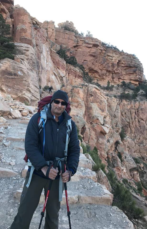
The thought of conquering the Grand Canyon was fairly intimidating and the use of the term “conquer” is fully intentional. And for someone like me being able to hike down and up the Canyon is quite a considerable accomplishment. Me and my mates never underestimated the Grand Canyon and based on the ratings, reviews, feedback, we wanted to ensure we prepared for the worst. And having heard horror stories of sizzling summer temperatures, we thought around fall was definitely ideal. So yes, November is actually a perfect time if you are well prepared to protect yourself against 36 deg F (5 deg C) temperatures at the bottom of the canyon.
And as D-day got closer the nervous excitement only enhanced and unabated. The weekends of carrying 20 pounds of stuff in my backpack and hiking up and down the Appalachians and work put in at the local gym is only part of the prep, as I found out.
Physical prep of course involved weekend hikes basically upto 5-7 miles on rough rocky terrains. In addition weekdays involved a few hours of spinning classes as well as other cardio workouts either on the treadmill or the elliptical machines.
Mental Preparation-
I always thought mental prep was overrated; however as I realized to my own advantage mental prep is probably as essential or significantly more so than the physical prep. Visualizing the terrain, building up the mental strength to survive 36 hours of rough rocky terrain, ability to brave the colds and keeping up a positive disposition are some things I can affirm clearly helped.
The gear-
Dress in layers, make sure you have a 60-65 liter hiking backpack, hiking poles, sturdy hiking boots, 1-2 liters of water (3 if you hike in the summer months), a light weight tent, self inflating sleeping mat and a mummy sleeping bag. You must definitely carry PB & J sandwiches, trail mix (salty foods are good) and dehydrated foods that you can feast on by adding a bit of hot water. A small gas heater was our life saver. A trip to one of the recreation stores (REI, Cabellas) is mandatory. A good night’s sleep prior to the day of the hike is strongly recommended. Do not get carried away by imbibing alcohol. You can always treat yourself once you are done with the “conquest”. Hand warming and toe warming pads help if you get too cold. If you cannot burden yourself with 20 lbs of stuff in your backpack, you can always book mules to carry the stuff and that’s always an option.
Make sure you have prior reservations to the Bright Angel Campground. Its a lottery and you must book it at least 4-5 months in advance. You do not have any option to camp overnight if you don’t. The NPS website has all the information. https://www.nps.gov/grca/index.htm
The hike-
Go for the South Rim, since its open all year round and remember the elevation at the top of the Canyon is close to 7,000 feet. You basically are hiking down to the Colorado river campground which sits at 2,400 feet. We took the South Kaibob trail to go down and it took us under 5 hours for a total distance of 7.5 miles. Not too easy to hike down but as long as you are able to sustain the balance and allow yourself to smell the roses.The sheer magnificence of the hike and the canyon layers of rock formations is awe inspiring. It can be very humbling. We started at 7.00 am and of course sunrise doesn’t occur until 7:15 so we were able to use the cooler temperatures to our advantage. And the first hour or two are when you are excited about taking pictures before monotony can set in. The last hour of the hike going down did take a mental toll not because it was full of additional switchbacks but we thought were getting closer to the base but we just weren’t there yet.
Getting to the campgrounds just around 1.00 PM gets you enough daylight to set up the tent, prep time for the food, eat and get it all sorted out prior to darkness setting in around 5.30 pm.
We took the Bright Angel trail going up. Its an extremely picturesque trail for the first half upto the Indian garden that sits at 3,800 feet. The hike gets steeper after that point but since the trail is not exposed directly to sunlight and goes past several cascades and varying vegetation and the occasion glimpses of deer and foxes, you are in a bettre place mentally. It took us under 7 hours to get to the top; 10.7 miles from the campground to the pinnacle.
If you are into it, you are going to love it truly; and you might even be tempted to go for it again and stretch yourself.
A few pictures just cannot do justice to the spectacle. You have to be there in person to truly appreciate the grandeur.
Other tips-
Fly into Vegas and rent a car and remember a AWD vehicle is recommended. Remember, adding a driver to the rental agreement costs extra in Nevada. And a charging bank for your devices is probably a no-brainer.
Oh Armenia- With a bit of tentativeness and some excitement I decided to venture to this erstwhile Soviet republic . With not a lot of information except bits from the Anthony Bordain show it was intended to be “go with the flow “ kind of trip. When a few guys decide to embark in alien lands with not even a rudimentary awareness of the language or culture, the trip actually becomes exciting; no expectations; just figure out what to do once you get there.
By sheer fortune, we were there when Armenia was celebrating its national day with massive street parties, concerts and the like including local cops in high heels! Yerevan (the “Y” is silent) is a city that hardly sleeps and you could easily get into any café or bar and get a decent drink. The city is ancient , tad older than Rome. Christianity is prevalent and it has that certain old world charm about it.
Besides the constant going out and checking out the eateries and bars, day times were spent visiting the Cascade monument; Nothing spectacular but a must do when you are there. We did a day trip to Lake Sevan- Pretty impressive to a huge lake inside Armenia 0ver 74 miles long and among the high altitude lakes in the Caucasian mountains . Several monasteries over 1,000 years old become part of the route and it’s a discovery worth going on to.
The country’s infrastructure seems quite adequate and we were impressed with the quality of the roads but language? That’s a whole different kettle of fish. The country itself seems to be a little confused. Not sure if they are fully out of the Soviet era yet or they are doing their best to be progressive. Outside the hotels or restaurants, finding a cabbie or a local that speaks half decent English was like having a root canal. Not that I expect every person on the street to speak English but certainly taxis drivers would have been conversant with the basic phrases; the relative rudeness of the taxi drivers is perhaps explained by their frustration caused by their inability to communicate?
Leaving aside the parties, the taxis and the city, the most poignant moment for me was the visit to the Genocide museum. Built on top of a hill overlooking the city, there is just not enough the world could do to remember the 1.5 million Armenians that were systematically exterminated by the Turks between 1895 and 1915 as part of the Hamidian, Adana then the Young Turks massacres. A journey through one of the painful chapters in history and you cannot even begin to comprehend what these folks went through. The pictures are heart wrenching and to walk through the museum without feeling a terrible sadness is just not on. RIP.
So what else? The dollar goes a long way. I was able to get upto 482 Armenian Drams (AMD) for $1 USD. A 10 minute taxi ride costs you upto 1000 AMD ($2)
Ride to the Republic Square from the airport will set you back 5,000 AMD ($11) tops .
Sumptuous breakfast for 4- Anywhere between 20,000 to 25,000 AMD ($40- $50)
Drinks and dinner for upto 4 people- Anywhere between 20,000 AMD to $35,000 AMD ($40- $72); depending on your imbibing and gluttony capacities of course!
Stay- Plenty of options but try to be within a minute or two from the Republic Square. The Marriott which is part of the Republic Square was where we stayed and it was certainly worthwhile. Well worth the $150 USD per night. Just make sure breakfast is included when making the booking. If not, make sure you get a rebated rate. Service is quite good, no hassles.
May not go back there but spending a good part of a week, I’ve come back with some great memories.